Margam to Aberavon Sands

Well it is the first day of Spring and we have decided to increase the pace and start walking some weekends with the kids as well (well some of them at least) – might be harder to convince the big ones!!

The compromise on this route was that because most of the walk coincides with national cycle path 4, the kids were allowed to use bikes (plus with them riding ahead then coming back they did even more miles) and it allowed Cleo to get a ride part of the way.

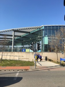
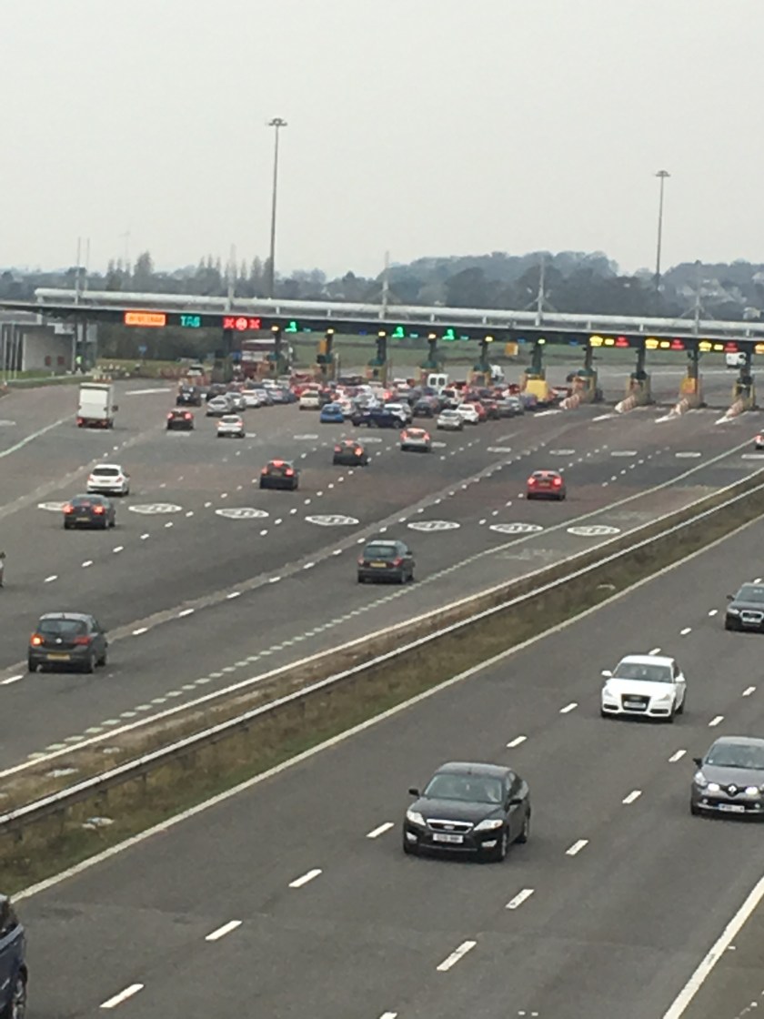
So we parked up at junction 38 of the M4 by Margam Crematorium and walked towards Aberavon Sands – this isn’t a single leg in the book we are following – but the end of the Porthcawl to Port Talbot route, and the start of the Port Talbot to Swansea route, so it will make both of those legs a bit more manageable in future weeks.

IMG_1407
Cleo getting ready in her basket

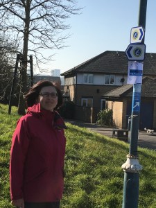
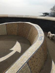
We soon found the coastal path sign (along with the alternative red route which goes through Margam park) – do we have to walk that as well in the future to say we have done it all lol?

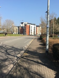
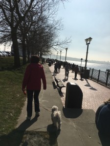
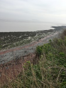
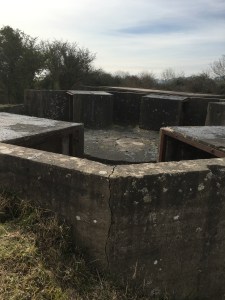
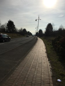
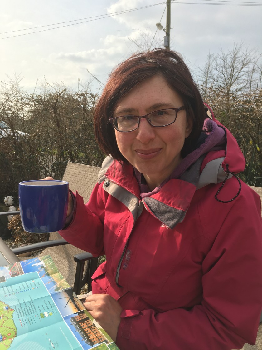
The first couple of miles really are not anything to write a blog about – So Cleo stayed tucked up in the basket with Rhiannon navigating.  Here is a selection of what we saw!!

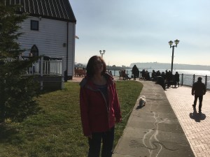
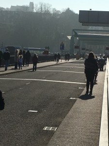
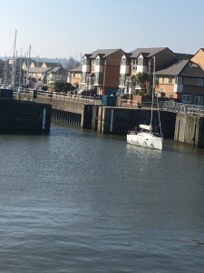
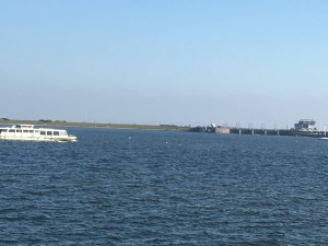
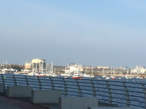
Then you end up on the main road to Aberavon and past a new blue cycle bridge, and along an estuary which is when it starts getting more picturesque and Cleo got to stretch her legs and walk for a few miles.

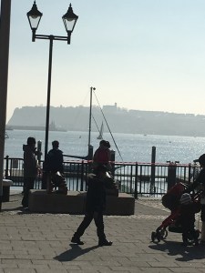
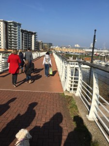
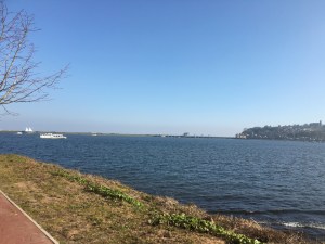
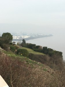
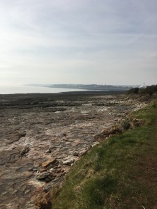
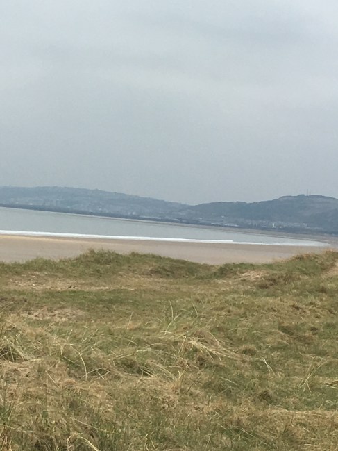
You head up a slight hill, and suddenly notice sand on the path and as you walk around a corner – bang – the most amazing views:

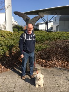
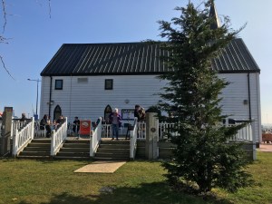
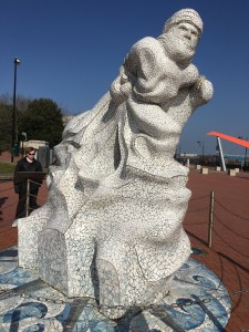
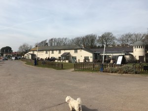
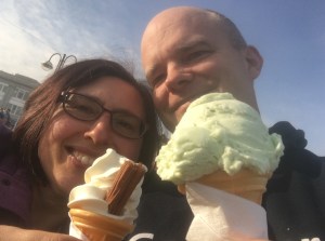
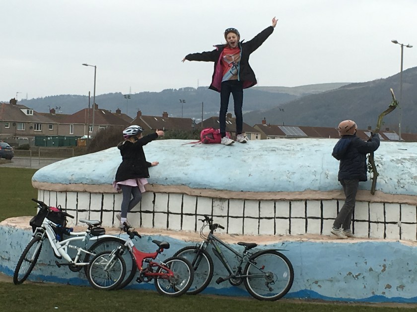
The walk along the sea front is beautiful (as long as you don’t look behind you towards the industrial area) and we stopped for hot chocolate and cookies on, of all things, a whale!!

IMG_1435
I’m queen of the whale
IMG_1436
Sharon chilling with the penguins

We decided to walk a bit further, so that when we resume this walk another day we can cut down from Baglan station, so it meant walking as far as the kids could cycle before the path diverted in land.

IMG_1437
Taking in some art (or trying to scale it)
IMG_1440
What a view!!

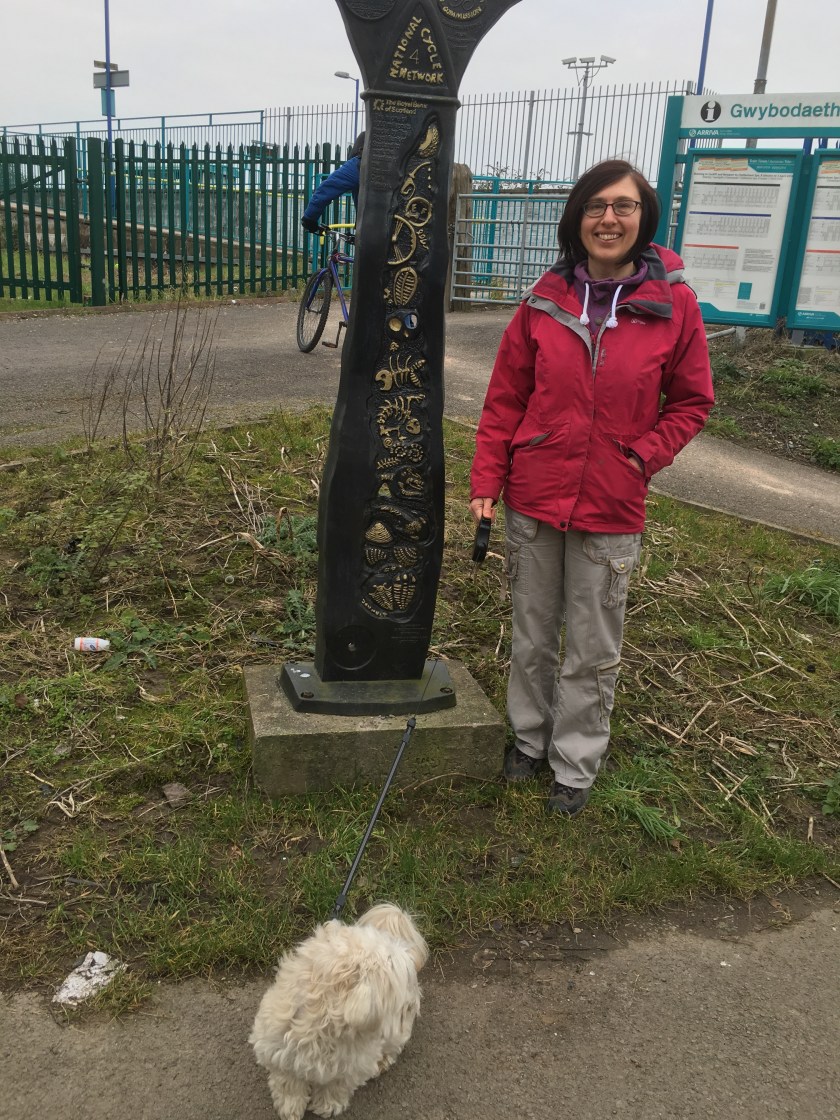
And that ends the coastal path element for today 6.5 miles done, making 63.5 miles completed and 806.5 to go.

But we had to get back to the car – so in a first for us, we had to then walk back again!! After a stop to play on the beach of course:

Nothing much to say about the return journey, pretty much the same as the way there and thankfully the kids rode a bit slower (until they got a couple of mini magnums inside them!!).

But it was good for us to have pace setters to keep us moving – according to Strava the total was 22.1 km (which is 13.7 miles in total today), and we managed it in just over 3 and 3/4 hours. Definitely getting fitter which is a good thing with all the walks we have got planned in the coming weeks, sometimes back to back as well – might have to take the kids again.

Andrew and Sharon

Cardiff to Penarth Marina and optional loop

The primary aim today was to complete a small section between 2 completed walks…. Cardiff to Newport starts from Tyndall Street, and our Penarth to Barry walk started at Penarth Marina, but there were around 2 miles unaccounted for between Tyndall Street and Penarth Marina. So with the sun shining what better weather for a nice stroll.

The first thing to say is that if you haven’t done this part of Cardiff as one of your regular walks then you will need to allow a lot of extra time for sightseeing along the way. The first part from Tyndall street is just along roads but once you get to County Hall it gets more interesting. For instance who knew that the Red Dragon centre is on the coastal path?

Outside the Red Dragon centre with a sign on the lamppost

Andrew at the marker sign with Cleo

I have sprouted horns!!

The walk continues pass the Millenium Centre and ahead you can just make out Penarth Church which we walked right past yesterday..

In the distance is Penarth Church

Famous sights litter the walk, from where the Welsh government meets to Dr who and the Norwegian church (now a cafe).

Talking shop
Talking shop
Norwegian church
Norwegian church

imageimage

Dr who
Dr who

This is by far the busiest part of coastal path so far.

The crowds
The crowds

The walk continues along the bay, past a play area and with time for us to watch the boats while Cleo played fetch with Mr Stickman.

View across the bay
View across the bay
Fetch
Fetch

The walk then heads across the barrage, which is a fascinating place to watch boats raise and lower to get out to the open sea.

The barrage
The barrage

image

Penarth Marina
Penarth Marina

And at the roundabout is the sign which marks the starting point of yesterday’s walk and the end of today’s …..or is it??

The sign
The sign

So for the coastal path stats that is 2 miles completed today making 57 miles completed and 813 miles to go.

But… If you have the time we highly recommend continuing on the 10k Bay walk to see the rest of what Cardiff bay has to offer. We had a motive…. Sharon’s youngest was swimming in a gala at the pool and we wanted to stop by to cheer her on (plus Sharon likes walking circles)…. So along the Marina we walked, over a footbridge and past the white water rafting to the pool.

Shadows on the bridge
White water rafting
White water rafting
Cardiff pool
Cardiff pool
Showing off her new swimming top

Then on we walked behind the skating rink, round the bay…

Bay views
Bay views

imageimage

Up some steps, along the road ridge over the bay and straight on up takes us past techniquest and back to Mermaid Quay to complete the loop. Total walk today 7.1 miles in just under 2 hours. Add on the 12.8 miles of yesterday and that is a grand total for the weekend of 19.9 miles…. Almost made the 20!! Off to Bella Italia to out some calories back in now.


Penarth Marina to Barry

A warm spring day, a little overcast, but a good day for walking – so we parked the car at Barry train station and took the train to Cogan (£5.20 single). Don’t ask how Cleo managed to get a muddy face before we even started!!

A muddy faced Cleo on the train

Cogan was about 1 km from the official start of the trail, so we strolled down to Penarth Marina and the starting point:

Penarth Barrage
Penarth Barrage
The start
The start

The first part was a steep uphill section of road into Penarth itself, past a church and along residential streets

IMG_1277

Then suddenly there is a left hand turn to the coast and the most amazing views of the sea and Penarth Pier

A new coastal path feature
Looking back towards Cardiff
The pier
The pier

We wound down the hill and along the seafront – stopping for a well needed bacon roll and coffee at The Fig Tree – roll OK, service very very slow so I stopped the clock on this one!! We continued up the hill and hit some decent path, the pace was good at this point, 1 km every 10 minutes or so.

A long straight path
The view below
The view below
One of the islands
One of the islands

IMG_1289 IMG_1290

Past an old WW2 lookout, and Lavenock church, and we then headed across Lavenstock nature reserve where things got a bit sitcky:

Mud mud glorious mud

IMG_1296

Just time to stop for a couple of selfies on a benchIMG_1295 IMG_1294

There was a stop to see an old WW2 gun fortress at Lavernock point, and then we had a clear view of Sully Island

IMG_1300 IMG_1301

Sully Island in the distance

At this point the coastal path goes inland behind the campsite – so we did as told – but our advice to those following in our footsteps would be to head down and along the beach and back up and save a boring mile or so.

On down into Swanbridge, and a great view of Sully Island –  The tide was out, and we chatted to some locals about the danger of heading across just before the tide turns – definitely one to come back to another day.  On past the Captain’s Wife (a pub not a person), and along the coast some more past Sully.

Captain's wife
Captain’s wife

IMG_1314

At this point after a snack the path has to head inland to get around Barry docks (although we suspect there is a way through somehow), a loo stop followed and then the longest most boring stretch of road into Barry with just lampposts to count.

Loooooo
Loooooo
one lamppost, two lamposts...
one lamppost, two lamposts…

Past the docks council offices, IMG_1318 IMG_1317

And then back to a nice part along the docks with the sun shining and the jumpers coming off.

IMG_1321 IMG_1319 IMG_1322

Under the railway line, turn left and there was our car by the train station. So the official walk was 19.4 km(or 12.1 miles) in 3 hours 32 mins, but excluding getting to Penarth Marina that is 11.5 miles of coastal path walked.  Taking our total to 55 miles done, 815 miles to go.

Then a stroll down to Barry Island for an ice cream added a further 1.2 km to our day (but not part of the walk) making 12.8 miles walked today (for Darren’s count!!).

IMG_1324

reward time
reward time

Caldicot to Newport Wetlands

Walk 4 – and having checked train times and wind direction we decided to walk from Caldicot (the end of our very first walk) to Newport Wetlands. This is one and a bit walks from our book and about 12 miles in total,but very flat. We chose to walk with the cold north easterly wind behind us rather than in our faces – a wise choice.

So off we set at 10.30 with a frantic run to Newport station for the train to Caldicot – £11.20 for 11 minutes on the train!!! – I need to get into this train driving lark.

And at exactly the spot the train stopped was the post which marked the end of Walk 1 for those of you following our tale:

IMG_1142
Remember this – the end of walk 1 is the start of walk 4 but less muddy!!

Our first dilemma – Sharon was certain we needed to turn left – I was equally certain it was right (given that was the direction the Newport train had come from) – eventually I won, but I could sense that Sharon thought we would be turning round in a while.

The first part of the walk was quite noisy, alongside the M4 on country lanes, but eventually we crossed over the M4 (legally) and headed for the coast:

IMG_1143
Over the M4
IMG_1145
The exact spot the speed camera van sits in above the 50 mph tolls

And when we reached the coast we could see the Severn bridge off to our left and Newport to our right:

So having concluded we were going the right way we set off along the coast. It was a cool but bright day and in the sunshine it was quite warm – our pace was good at between 10 and 11 minutes per km in walking boots, and soon we made it to our lunch rock.

Stopping, as always, was a mistake and we were quite cold and a bit slower after the lunch break, but we continued along the coastal ridge, all the way past Redwick and on to Goldcliff.

There is a famous pink house with equally famous angry occupants along the way, so we obeyed the sign – apart from the photos bit and carried on our way.

IMG_1165
Shadow snuggle

At GoldCliff we were met by a nice surprise – The Seawall tearooms, where we sampled the hot chocolate and a piece of carrot cake and a piece of lemon cake – the cake was delicious, and Wendy, the owner was very welcoming and friendly – well worth a stop if ever you hit this bit of the coast. Cleo even got some doggie biscuits

IMG_1151
Along the ridge
IMG_1178
During cake
IMG_1172
Post cake
IMG_1171
The Cake


IMG_1195

We then headed inland a bit as we started across the wetlands, past the Farmers arms (a pub) through countless gates, and besides some bird spotting hides:

IMG_1185
Here birdy birdy

The pace slowed as the old war wounds of 2 weeks ago surfaced, but we made it on to the wetlands site and round to the lighthouse for the end of walk 4:

Just time for a selfie before calling for Mum taxi to pick us up and take us back to our car – 12 miles in total in just under 4 hours, and a walk well worth doing if you find yourself in this area. 43.5 miles done, 826.5 miles to go!!

Cardiff to Newport

It’s been a while since our last walk – but after some debate we decided to do our longest walk so far yesterday – from Cardiff to Newport.  Yes, yesterday, we were in no fit state to write up the blog when we got back last night!!

So, the 11.10 train got us into Cardiff for 11.35 and we headed off to the starting point on Tyndall street for a 14 mile walk to the roundabout just past work in Newport, and about a mile short of the transporter bridge.

The first couple of miles were all roads and industrial estates…

Our starting point
Our starting point
Not so coastal here
Not so coastal here
Less than a mile in and Sharon spies a Greggs

After walking along Ocean Way and Rover way we finally cut right and found the coast and walked for a mile or so behind the water treatment plant, and the traveler site.

The coast
The coast
More coast
More coast
Our biggest ascend of the day

IMG_1045

Ex RAF base
Ex RAF base

IMG_1048

Traveler site
Traveler site

We then passed very close to Tescos at Pengham Green but decided that walking across the whole car park to get food was a trek too far – a decision we would later regret. A bit more road walking followed before we again headed towards the coast, and a nice quiet canal on the way…

IMG_1056
The first of many swans
IMG_1058
Looking back to Cardiff
IMG_1059
A good spot for lunch

And now it was lunchtime – well I say lunch but all that was left in the bag were 2 bags of pickled onion monster munch and a coffee, and even stopping for 5 minutes made us quite cold – but Cleo got acquainted with the new member of our team – Mr Stickman

Lunch please
Lunch please
Mr Stickman
Mr Stickman
Fetch
Fetch

And off we set at a faster pace to warm up, meeting some horses on the path

Excuse me please
Excuse me please
Is this Peterstone or Marshfield?
Lots of coast
Lots of coast

And on the walk went – the rain started falling lightly, and the path was muddy under foot – we started debating where to ask Mum to pick us up from – but she will never find us by here.  Then we found the West Usk Lighthouse Inn – right on the coast – success – unfortunately the chef had a “family emergency” which coincided with the Wales match so we made do with a coffee and crisps again.

IMG_1081
Mud Mud
IMG_1082
A welcome warm up by the fire and a brief watch of France v Ireland before on we went

The signs still said 6km to go, the feet said to stop, but we were averaging 5km an hour so the end must be in site – another 1.5km brought us to the lighthouse, and over the river we could see the wetlands, the site of a future walk.

The lighthouse
The lighthouse
so close to the wetlands but a few mile to get there
So close to the wetlands but a few mile to get there

And with the transporter bridge in our sites we carried on, until the path turned us away from the bridge and on towards Duffryn. Then we hit our big snag of the day – the bridge we were supposed to cross was closed, well gone actually, as part of the railway Electification work.

Left and right are the bridge, in the middle isn't a bridge
Left and right are the bridge, in the middle isn’t a bridge

Turning back would add 3 or 4 miles to the day, so we don’t let little things like that stop us and we carry on the walk – although at the other side of the bridge there is a useful sign…

If only this was on the other side

A short work on the bike path concluded today’s walk at just before 5pm, 23.4km, 14 miles completed, 4 hours 58 minutes.

Our finishing point IMG_1092

And we have big plans over the next couple of weekends to join up the parts we have done so far and complete this section – once Andrew can walk again that is!!

Llantwit Major to Southerndown

After a lot of changing our minds, we decided that for our second walk we would do the Llantwit Major to Southerndown route which is 8 miles.  We headed to Southerndown where we left the car to catch a bus into Llantwit Major. It was a rather foggy morning with not a lot to see at this point:

Southerndown in the fog

But while waiting for the bus the fog magically lifted – the guidebook said that bus 145 was the one to get us to Llantwit Major, but that had been replaced in 2013 by the 305, which turned up 15 mins late, and we were on our way.

Cleo excited to be on the bus (maybe)

Once in Llantwit Major we headed for the beach (which explains why we walked nearly 2 miles further than the coastal path today), grabbed a coffee and hot chocolate and headed up the first cliff.

Cleo posing with Sharon nice and clean before the walk
The view from the cliff down onto Llantwit beach

We had debated whether to go with walking boots or wellies, and opted again for wellies, which turned out to be the right choice after the first mile which was mainly spent sliding from side to side in the mud.

mud mud glorious mud
Sharon high-hurdling

We found a contender for house by the sea at Tresilian Bay

Fortresses
Fortresses
Wild mushrooms
Wild mushrooms
Tresilian House
Tresilian House

Once we climbed up the other side of this cove we were faced with a problem:

End of the walk?
End of the walk?

Part of the path had fallen off the cliff into the sea below, but we were able to detour slightly and keep the walk going:

And not up here
The path is not up here
Is down there...
It is down there…
The missing path
The missing path

Lunch followed at St Donat’s castle

St Donats's castle
St Donat’s castle
Lunchtime selfie
Lunchtime selfie

And off we set on better paths to the Nash Point Lighthouses

Nash Point lighthouses as we neared them
Nash point lighthouses in the distance
Well mostly better paths- Sharon did have to swim across this one
Well mostly better paths- Sharon did have to swim along this one

The rest of the walk was one of the most picturesque and quietest walks we have been on, very few people had ventured out today, and this was one we will return to on a summer’s evening when the views will be even more spectacular:

601
Which bridge should I cross?
This one is safer!!
This one is safer!!

599 607 608 611 614 616 619

There were some massive slippery slopes to climb down, and some equally large hills to climb up, and Sharon gained the first injury of the walks when she slipped on to some gorse and drew blood (I didn’t pass out!!).

Another bridge to cross
Over a very pretty stream

And time for a very nice view while eating afternoon tea

Afternoon tea view
Afternoon tea view
Cleo enjoying a rest

And before we knew it the walk was almost at an end as we past through Dunraven castle, and on over to Southerndown and our waiting car.

For those who like statistics (and who wouldn’t!!), the walk was 15km or just under 10 miles, and took just over 3 hours including breaks.  During the walk we gained a total of 654 metres in elevation.  So that is now 17.5 miles completed, and 852.5 to go. Already planning the next leg of our journey.

Andrew and Sharon

Chepstow to Caldicot

An early start (which is not easy on New Year’s Day – Happy New Year to you all by the way!!) as the rain was forecast from 2pm, and we got to Caldicot train station by 9.30, for a quick journey to Chepstow. Cleo’s first ever trip on a train as well.

Waiting for the train
And on we go
And off we go

We decided to walk from Chepstow back to the car in Caldicot and, after stopping off for a Costa, we headed for the Bandstand which starts the walk (we had been advised that wellies would be more suitable than walking boots for today’s leg of the journey).

The wheel showing the sections of the walk
This is us (before the walk and smiling)
And this is Cleo - nice and clean at this stage
And this is Cleo – nice and clean at this stage
The coastal path is 870 miles - today we are attempting 9.5 miles
The coastal path is 870 miles – today we are attempting 9.5 miles

There isn’t really much to say about the first 2 or 3 miles – once you get out of Chepstow town centre it is all suburban streets, industrial units and woodlands, following the signs but not seeing much coast at all, as the sign explained…..

One of the signs which will become all too familiar
Andrew with Cleo at the Chepstow wall
Cleo and Sharon racing ahead
The sign explaining why the coastal path had no coast!!

But once on the coast proper we found a fish, and had our first casualty as the water bottle dropped to the floor and shattered.

Andrew is the one on the left!!
A fish out of water
A fish out of water
The first casualty
The first casualty

A church and a nice statue of King Tewdrig soon followed and the walk then took us across a few very swampy fields some of crops and others of animals – including, according to Sharon, some very pretty sheep (she has been living in Wales too long!!).

King Tewdrig
King Tewdrig
The church
The church
A very muddy Cleo
A very muddy Cleo
Another muddy field
Another muddy field
This field was flatter and less muddy!!

After stopping for a wee, crossing the golf course briefly and then the train tracks we finally started to see the coast and some lovely views of the Second Severn Crossing, before having a paddle at Black Rock.

Look left and right
Look left and right
IMG_0789
Like the Monaco harbour
The Severn Bridge
The Severn Bridge
Black Rock
Black Rock
The water is lovely - come on in
The water is lovely – come on in
IN the sea at Black Rock
In the sea at Black Rock
Hence why it is called Black Rock

At Black Rock we also got an update on our progress – 6 miles completed and just 864 to go!!

A statistician needs some figure work
The 6 is good (miles completed)... the 864 is not so good!!!
The 6 is good (miles completed)… the 864 is not so good!!!

The last part of the walk is the best for views of the Severn Estuary, and for landmarks – we crossed under the Second Severn Crossing, then walked along by the motorway (the famous windsock you see as you drive over the Severn bridge) and then we crossed over the M4 on a footbridge.

Under the Severn crossing
Looks magnificent from this angle
The windsock
The windsock
Over the M4 we go
Over the M4 we go

And the end was in sight – 9.5 miles, in just over 3 hours, the wellies and swampy conditions didn’t help but we beat the rain, and boy are we shattered – I bet even Cleo sleeps well tonight after a well-earned bath.

Newport left and 16 miles (via a shortcut)- the car is right - we choose right!!
Newport left and 16 miles (via a shortcut)- the car is right – we choose right!!
Cleo having one last pose

And off now to plan the 2nd leg of our mammoth journey. This morning Sharon said we should try to do all 870 miles during 2016, let’s see if she is sticking to that plan tomorrow.

Andrew and Sharon

%d bloggers like this: