The North Wales section walk by walk

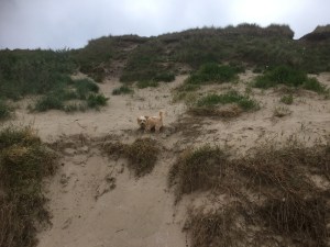
It took 3 separate trips up here between 7th October 2016 and 21st March 2019 but we have finally completed the 8 legs which make up the 93 miles of the North Wales element of the coastal path. Sadly Cleo never got to do any of this section but Bonnie has seen some of it.

This page details the walks we have made on this section of the coastal path in the order that they flow around the coast, and not necessarily the order that we walked them in.

9th October 2016 Flint to Chester – 12.5 miles walked mainly along the Dee Estuary, and the end point was both rather dark and an anti-climax with a very small plague to mark the end/start of the coastal path. But it was a flat day if rather quiet with not much to see.

8th October 2016 Prestatyn to Flint – 18.5 miles of coastal path today, starting with a teddy bear’s breakfast. We saw sand dunes, a haunted lighthouse, were held up by escaped sheep, a dragon and Flint Castle made for a very good day of walking.

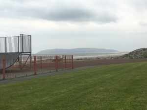
10th October 2016 Rhyl to Prestatyn and back again – 5 miles of coastal path on a 16.2 mile walk. Glorious autumn sunshine, a beautiful beach and lots of cake. Even saw some colourful seaside huts.

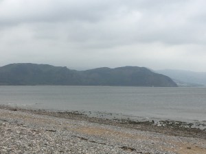
7th October 2016 Colwyn Bay to Rhyl – a 10 mile walk today in quite chilly weather but it was very flat. We had time for pooh sticks with flowers, a little “wee” dance, some crabs and then our caravan had a view from the bedroom window of the coastal path.

5th May 2017 Colwyn Bay to Llandudno – 12.2 miles of coastal path and again the weather was glorious. Little Orme, an incident with Sharon on/off the bike, the smallest church in the UK, Llandudno pier, and then around Great Orme.

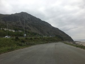
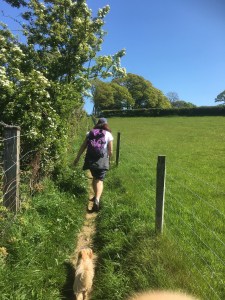
6th May 2017 Llandudno to Llanfairfechan – 12.1 miles where we chose the “flat” route. We had sand dunes, Conwy Castle, the smallest house in Britain, a scary route besides the motorway (with lorries 1 metre away from us) and our arrival in Llanfairfechan.

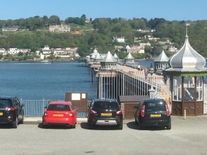
7th May 2017 Bangor to Llanfairfechan – 10 miles from the Pier in Bangor, on a glorious day through woodland and beach, and a wild bird reserve. Then Bonnie took a dip in a lake and had to be fished out before we finished with ice cream and a snooze in the sun.

21st March 2019 Caernarfon to Bangor – 10.9 miles along the Menai Strait with a lot of bike path and roads, as well as some woodland and a finish on the beach to get to the pier before it got dark.

We hope you enjoy reading about the North Wales section of the coastal path and are inspired to follow in our footsteps. There are moments of pure beauty on this part of the path, but also a lot of roads and flat parts which break up the day.  8 days seems about right and we did it in 91.2 miles all in which is a lot less than the Isle of Anglesey.

Caernarfon to Bangor

21st March 2019

Our first walking weekend of 2019 – and a series of landmarks today for us. This walk is the prelude to our first weekend of walking on Anglesey. It is also the last walk in the North Wales section of the book, and the walk which takes us over half-way around the coastal path of Wales.

After a 4 hour drive to get here we were raring to go as and parked in Bangor and got the bus to Morissons in Caernarfon to start the walk. The entire walk today is along the one side of the Menai Strait, past both bridges and to the Pier in Bangor to join up with this walk.  The first few miles of the walk followed the bike path so were flat and easy.

Our starting point which follows the bike path

The tide was on it’s way out and the Menai Strait looked calm, if rather cloudy.

The long and flat bike path

We then headed through a boat yard at Port Dinorwic and across a small bridge to a new part of the coastal path which has not long been open.

Some lovely views of Anglesey
The boat yard
Bonnie balancing herself along the wall
The bridge, which could easily be missed

The walk then turned to woodland and up a hill.

And then we went through the Faenol Hall estate, and our first mistake of the weekend. We went straight across a field of sheep rather than behind a fence along the edge. We only realised this when we spotted a walker behind the fence, and decided to climb the fence to join the path – only for the path to then go through a gate and back into the field we had just left!!

Sounds like an ad break

And then the first Menai bridge came into view – Pont Britannia, the newer bridge which lorries can use.  I say newer but it was built in the 1850 as a rail bridge but after a fire in 1970 it was remodeled to take vehicles.

Pont Britannia
Cars and lorries go across the 2nd layer

Then a series of small islands came into view in the Menai Strait – and although they were very pretty houses, the noise from the roads must be rather annoying.

Another wood then followed through Treborth Hall.

Bonnie takes the lead through the wood

And then the original Menai Suspension Bridge (built in 1826) came into view, and this one we had to walk up to rather than under.  More on the Menai bridge later in the weekend when we cross it.

Menai Bridge comes into view
A bus tackles the arches
A majestic bridge

After a further section of flat walking along the A487 the path turned left and went past Bangor football ground (a free game if a match is on), and then over a series of stepped ups and downs through woodlands at Nant-Porth.

As it was now low tide we were able to walk along the shore towards the pier and our end point.

The end is in sight

And Sharon was not hanging around.

A small boat yard which we used to cut back up to the road

And then we arrived at the pier: deliberately an easy first day as we couldn’t start till 1pm. And again we couldn’t go onto the pier because we had Bonnie with us.

Our end point

Unfortunately at this point Sharon’s phone died – unfortunate for her as her bus pass was on the screen, so I got the bus back to the car and met Sharon at the supermarket once she had bought the items we had forgotten to pack.

So today was 10.9 miles in 3 and a half hours, with 653 feet of height. More importantly it takes us to 441.8 miles completed and 433.4 miles to go – whoooo we’re half way there, and after only 3 years and 3 months.


Colwyn Bay to Llandudno

5th May 2017

Now we are back up and walking we decided to have our first long weekend of the year, where we travel further afield and try to complete a number of legs back to back. So this time we went back to North Wales to continue where we left off at Colwyn Bay and needed to walk West rather than East.

So after a drive of over 4 hours we parked on Colwyn Bay promenade by the old pier. Sharon had the bright idea of taking bikes today to get through the ‘long flat parts’ of the walk. This walk finishes off the Llandudno to Rhyl section we started last October and starts the Llandudno to Conwy section. So at 2pm we headed along the promenade briefly before soon being forced on a detour inland while redevelopment work was taking place.

Our starting point and the detour

We quickly returned to the coast and what a lovely afternoon it was.

Look at that sky
Showing the way

This weekend also gives us three British records…the first is the smallest church in the UK at Rhos-on-sea….or is it? St Trillos seats 6 and would be perfect for a small wedding!!

The smallest church in Britain?
A possible wedding venue for next year?

Then on we went past a golf course and a housing estate towards Little Orme. We had thought we could go around it, and laughed as we passed a steep uphill path.

Our first challenge…Little Orme
Not so little

But after getting to the coast we realised there was no way around Little Orme and the coastal path actually went over it!

The way up!!

Has anyone ever been crazy enough to take a bike up Little Orme? They have now!!

Go Sharon
The view is worth the climb

The views were magnificent though and what goes up must come down, so we headed down the tracks…until I got worried that I couldn’t hear Sharon’s brakes squeaking so I stopped and ran back. In my defence I did check Sharon was breathing before I took the picture …she was ok but did get some big bruises… I asked what had happened and Sharon replied “I fell off!”

Ouch

Bonnie was not involved in the crash and was just having a Lassie moment. Once we were up and running again it was a fast downhill all the way into Llandudno along the promenade.

Llandudno looking back to little Orme
Mad as a hatter…part of the Alice trail
Little Orme

We parked up the bikes and took a walk on our second record breaker… Wales’ longest pier and the fifth longest in the U.K. A nice coffee and cake later and we were ready to cycle around Great Orme, but even then we had a long steady climb which we ended up walking most of.

They even put out the welcome for us
Big Orme
What a view
Bonnie still full of energy

As we rounded the head and could see views to the south we readied ourselves for the big downhill.

Llanfairfechan in the distance
Ready for the downhill again, stay on this time

We hit 29mph heading down which made dragging the bikes around all day worthwhile. The Cheshire Cat marked the end point of today’s walk.

Smile!!
A pretty map and 990 feet of ascent

Andrew took Bonnie on the bus to collect the car, and she slept all the way.

Time to sleep on the bus

The stats for the day in terms of the coastal path are…6 miles of the Rhyl to Llandudno leg completed and 6.2 miles of Llandudno to Conwy making 12.2 miles in total. The overall total is now 258.1 miles completed and 611.6 miles to go. Time to rest up for a long walk tomorrow.

Llandudno to Llanfairfechan (via Conwy)

6th May 2017

Day 2 of the weekend and we are leaving the bikes behind today. The first part of the day will complete the Llandudno to Conwy walk while the second will walk the section from Conwy to Llanfairfechan.

The start point is the end point from yesterday

At this point we were unsure which route to take later in the day from Conwy; the traditional coastal path route of 9 miles or the mountains of the alternative route which is 11 miles and has 600 metres of ascent to get to the highest point on the whole coastal path (hence no bikes today!!).

We are heading for here

It was overcast but dry today, and the first few miles were flat and sandy as we followed the river Conwy estuary to reach the bridge to cross into Conwy.

A mountain dog, she loves the sand.
Sandy walk
The bridge in the distance
The estuary

The castle at Conwy is very impressive and dominates the town.

Conwy castle

We stopped for a look around the shops before heading for the quay and our next British record….Britain’s smallest house.

Smallest house in Britain

By now we had walked over 4 miles and it was decision time….11 miles of mountain walking or 9 miles of flat walking. For once we took the safe option and went the coastal way.

We came from there

But we stopped for a selfie in front of the mountains!!

Bench selfie with the mountain route behind us

In hindsight we made the right choice; the views of Anglesey were fabulous plus Bonnie was struggling after 12 miles. Most of the walk followed the A55 and the train line, at one point far too close with lorries winding their way around the coast less than a metre from us.

Anglesey

We found a picnic bench for lunch with nice views over the Menai strait. Then a final push to get to Llanfairfechan including one quite steep climb, then over the A55 and to the car park.

Lunchtime

We made it

At the last traffic lights the red mountain route joined back up with us, and we waited for the bus to take us back to Llandudno and the waiting car.

Red route joins up

In total we walked 12.1 miles of coastal path. In hindsight today was a much better candidate for bikes than yesterday as we pretty much followed the bike path the whole way. This makes 270.2 miles completed and 599.5 miles to go. On the way back we were already planning tomorrow’s walk as well.

Bangor to Llanfairfechan

7th May 2017

Day 3 of the weekend and the plan was to join up to Bangor. We decided to park in Llanfairfechan and get the bus to Bangor. Unfortunately we missed the stop to get off; ended up in the town centre and had to walk over a mile back to get to the coastal path!! But on a beautiful day like today we weren’t going to worry too much.

Bangor university

We passed Bangor university on the way to Bangor pier….the 2nd longest pier in Wales and number 10 in the UK.

Wales’s second longest pier

The photograph is slightly deceiving as the pier reaches about halfway across the Menai Strait, but here is looks like it is almost touching Anglesey in the background. This is about as close as we will get to Anglesey until we start walking it (amazingly Anglesey is 50 miles more walking than the whole of Chester to Bangor – it will take 11 days and 130 miles to get right round Anglesey).

Anglesey to the left and Llandudno and Llanfairfechan to the right
Llanfairfechan
Tempting to go that way but need to head inland

After a brief walk along the coast the coastal path turns abruptly right and heads inland through the woods. This might change in the future if Penrhyn Castle ever gives access across it’s land.

But the woods were beautiful with the bluebells in full bloom.

Perfect timing

Eventually we turned off the woodland path, near a ford and along a road. A new section of coastal path diverted us off the small lane and onto a pavement through an empty area earmarked for an industrial estate. Then we walked through fields and roads, zigzagging our way back towards the coast.

Over a river
Past some fields
Across a sheep field

We then reached a nature reserve and here we should have stayed on the road and down to the car park, but we were so distracted by the unique opening gate that we entered the reserve instead.

Unusual gate

No harm was done and we popped through an opening and out onto the beach where we sat on the picnic blanket for lunch.

Time for lunch and what a blue sky

From then on we stayed on the coast, sometimes on the beach, other times on a path besides the beach.

Cute house, possible seaside home?

Bonnie showed off her balancing skills along the wall, but sadly wasn’t quite as skilled when she reached the duck lake where she leant forward too far and fell in. We discovered Bonnie can swim but she needed a helping hand to get out, and looked like a drowned rat afterwards.

Good balance
Drowned!!
Llandudno looks like an island

Only in Britain would there be children playing on the beach in bathers in 15 degree weather.

Where is the water?

Before we headed back to the car we stopped for an ice cream and a little snooze!!

Another ice-cream selfie in the sun
Sleeping “beauties”
We’ve been both ways from here now!

So that was the end of another wonderful walk in sunshine with 10 miles of coastal path completed today. We have now walked the first 82 miles of coastal path from Chester to Bangor, and the last 81.5 miles of coastal path from Southerndown to Chepstow.

Overall we have now walked 280.2 miles and have got 589.5 miles to go… below 600!! A wonderful weekend of walking and we have really enjoyed the North Wales coast, it is very beautiful.


Rhyl to Prestatyn and back

10th October 2016

For our last walk of the weekend we needed to join up the gap we had left between Rhyl and Prestatyn. We decided to walk both ways and spend a bit of time in Prestatyn along the way, hoping to find some quaint seaside shops.

So from the campsite we headed straight out onto the coastal path on a glorious day – we had really been lucky with the weather this weekend.

img_5248
The tide is out, the beach looks lovely and there are the wind turbines
img_5250
A fabulous beach

Walking this way you have to cross Rhyl Harbour on the new footbridge.

img_5252
Rhyl harbour
img_5253
The footbridge
img_5255
The view the other way

And then we walked along Rhyl seafront, and we have never seen so many mobility scooters – there must have been a convention or something!!

The old swimming pool complex that Sharon could remember going in as a child was being knocked down (well it was quite old now!!)

img_5258

img_5260
The beach stretches out to Prestatyn

And the beach stretched on for miles and miles, coffee and cake after coffee and cake… hence the smiles…..

img_5261

And before we knew it we were at Prestatyn with it’s beachhut-like leisure area.

img_5262 img_5264

A detour into town for a shop – no, nothing worth buying, and a nice lunch and we then headed back the way we came, except for one small detour:

img_5266
Time for one last selfie and yes, Sharon did have an ice-cream as well, she just hid it from shot

The end of a fabulous walking weekend – today was 16.2 miles in total taking the weekend total to 62.7 miles, but only 5 miles was counted towards the coastal path total, making 233.9 miles walked and 636.0 miles to go still.

We are already planning our next trip up to cover off Conwy and Llandudno down to Bangor, so it won’t be long till we complete the whole of the top of Wales.

Flint to Chester

9th October 2016

This walk is on page 1 of our book (which walks from North to South) and we were hoping for as big a momument in Chester as there was in Chepstow all the way back on 1st January 2016.

We confess that after yesterday’s 18.9 miles we could have done with a rest day, but this was a flat and short section, so we deliberately started the day quite late and at a relaxed pace.

img_5227

And today did remind us a bit of that first leg in Chepstow, although the walk here was a bit nicer. There were handy markers along the pavement showing the coastal path symbol and directional arrows for both ways, rather than the usual signs, which were slightly harder to spot.

Today was all about walking the Dee estuary, with Ellesmere Port on the other side of the river, and parts of the walk covered industrial estates, and fishermen in lines along the river.

img_5228
The new Queensferry crossing
img_5232
Industrial units
img_5231
A statue

The path follows the estuary for quite a while but then suddenly you cross the estuary at the small old Queensferry crossing, and the last few miles of the walk are on the other side of the river – still technically in Wales apparently.

img_5233
A view across to Ellesmere Port
img_5234
The Dee estuary once we had crossed

I confess that our pace was not fast, and our start was late, and suddenly darkness descended, and it felt quite lonely walking along the last part of the path in the dusk, with only the occassional cyclist with their lights, and a mobility scooter to keep us going. We weren’t even sure we would know where the coastal path ended but we found it.. just….

img_5236
A small worn plague on the floor
img_5242
And two stone pillars, but they didn’t come out very well in the dark

And that was that, not quite the atmosphere that we had hoped for, and a bit dark, but we had walked the last leg of the coastal path (without a lot of the middle). Which section becomes our final leg to complete the whole path remains to be seen, but to have done the start and the end this year at least felt good, mirroring (in my mind at least) a year of highs (getting engaged) and lows (the loss of Cleo).

But our challenge wasn’t quite over as the coastal path ended in the middle of nowhere and we still had to walk into Chester city centre and find the train station to board the train back to the car with a train full of drunks – oh this is the life!!

So 16 miles walked today, of which 12.5 were coastal path making 228.9 miles in total and 641.0 to go. One more day – let’s hope it is easier and lighter!!

Prestatyn to Flint

8th October 2016

Day two of our weekend saw us head from Prestatyn to Flint and, due to an issue with a missed page, this turned out to be further than thought (well than Andrew thought), so it turned into a very long and hard day.

We drove to Prestatyn and parked up by the station, leaving us a short walk to the sea front to pick up the coastal path by the Prestatyn pool. But first some breakfast at Teddy bears and tea pots – yes really – every table had a teddy bear sat in a chair and all around the room were – teddy bears and tea pots – we had a feeling of Norman Bates about it all – but the bears were well behaved and the food was good.

img_5189
Teddy bears and tea pots restaurant at Prestatyn

The inital part of the walk was similar to yesterday, along a path by the coast, but quickly the ground changed to sand dunes and rough plantation and it was quite undulating for a couple of miles.

img_5194

After an excursion through PrestHaven (the Haven campsite) we reached a beach we could walk along, the tide was out and in the distance was a disused lighthouse, said to be haunted by a previous occupant.

img_5198
The beach
img_5202
The haunted lighthouse

The path then headed off the beach – signposted by the best looking signs of the whole coastal path so far….

img_5203

Across a car park, and around a gas plant, with a nice sculpture on route.

img_5207

After going under a bridge we were held up for 10 minutes while some stray sheep were rounded up and carried on to the awaiting trailer, then off we went again along a ridge and then a few roads, a bit in land from the coast.

img_5209
Come on Shaun

The path then followed the coast except for small estuaries where we had to come in-land, walk along the road a bit then back out again – but one of these in-land sections gave a lovely view.

img_5215
One of my favourite views of the day

By now we were really flagging, all the coffee was drunk, and food supplies were low. We headed for the dragon on the hill which is one of the millenium beacons used to light up a network around the country.

img_5219

A small diversion followed to find a Home bargains to stock up on drinks and snacks and then we found Flint castle (closed alas), with time for a selfie.

img_5224
Flint castle….nearly finished
img_5225
The picture doesn’t reflect just how tired we were by now

And that was this leg completed – a massive 18.9 miles walked and 18.5 of it was coastal path, so the total moves on to 216.4 miles completed and 653.5 to go. 2 more days of this yet!!

Colwyn Bay to Rhyl

7th October 2016

Our first walk since Cleo passed away and, to be honest, we probably only did this because the caravan had been booked for months. So we headed up to Rhyl (a 4 hour 30 min drive!!) and found the camp site – the view from the caravan window (while not exciting to most people) was amazing as that path seen out of our kitchen window is the coastal path – we are going to be sleeping about 6 feet from the coastal path!!

img_5267

So we walked the 2 miles into Rhyl and caught a train to Colwyn Bay. The weather was overcast but mild for October and the walk was mostly flat. The path was never more than a few feet from the coast on our left, and the wind turbines out to sea were a constant view point.

Colwyn Bay itself is rather run down, as shown by the pier, but the town is trying to redevelop and the beach looked very nice.

img_5160
The rundown pier
img_5165
Our first Coastal Path signs of the day
img_5167
Will she or won’t she…. she won’t as it turns out, well not without help!

Behind us was the sticky out bit of Llandudno (which will have to wait for another weekend) and ahead of us Rhyl stuck out so there was nothing else to see really.

img_5169
Llandudno to the West
img_5172
What are these??

The mystery of the weekend was why the tidal wall was made up of what looked a bit like the top of corkscrews, all made out of concrete and  all individually numbered – over 20,000 of them in total – does anyone know what they are or why they were used here?

Our pace was quite quick, but we needed a refeshment stop and found a very nice cafe which made a lovely cup of tea….

img_5182

img_5184
The beach cafe

A stop for a game of pooh sticks on the nature reserve and before we knew it we were at the camp site, with a gate right on the coastal path.

img_5176

So for today the total walked was 11.6 miles, of which 10 were coastal path taking us to 197.9 miles walked and 672.0 to go – nearly at the 200 mile point.

%d bloggers like this: