South Wales Coast and Severn Estuary Completed

During October we completed a complete chapter of our coastal path book…Chapter 8 from Swansea to Chepstow…which is (according to the book) 118.5 miles long and gains 1780m in height ….who knew Chepstow was so high up!!

We thought it would be nice to link all the walks we have written up together in book order.

So the first walk according to chapter 8 of the book is from Swansea to Port Talbot, which we did in 2 stages, firstly we have Briton Ferry to Swansea which was our first walk of 2017 on 19th April, where the main roads into Swansea soon changed to be a nice canal for the 6 miles we completed. The second stage was Briton Ferry to Aberavon which we completed on 24th September 2017 with the optional extra loop of over 200 storeys of height and 9.7 miles completed.

The next page of the book is Port Talbot to Porthcawl and again we broke this into 2 walks using Margam Crematorium as a start and end point(and with over 18 months between the two parts). Our walk from Margam to Aberavon Sands was our first walk of Spring on 20th March 2016, although you wouldn’t know it from the coats, and it was a contrasting walk between industrial harshness and beautiful beaches over 6.5 miles. The other part started again at Margam, but this time we went from Margam to Porthcawl and this walk had a bit of everything from roads and lanes, and train lines, marshes and mud, dunes and beach, boardwalks, seafront and roast dinner and all within 8.8 miles.

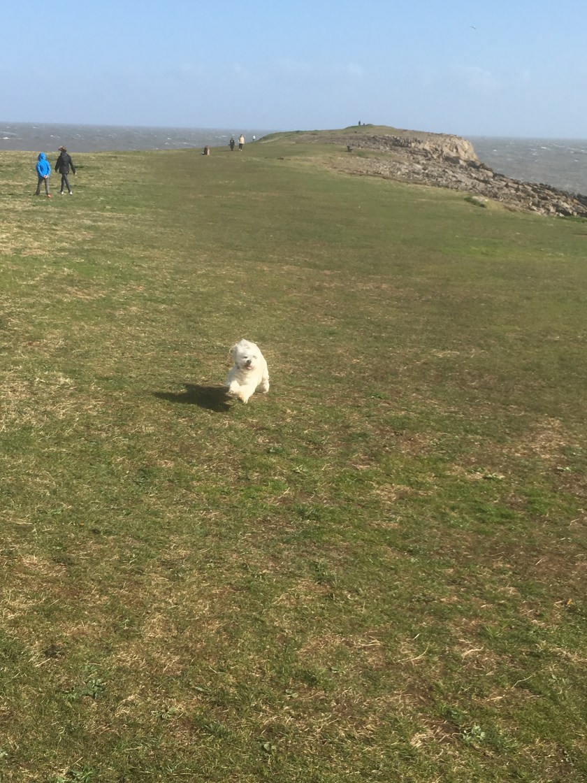
Next in the book comes Porthcawl to Southerndown, which we did again in 2 stages. We joined up Ogmore to Porthcawl on the 1st May 2017 and here we had the famous stepping stones incident (Andrew is still trying to forget it), a beach walk, the fun fair and chips before a storm, which was 6.2 miles. Then on a beautiful August bank holiday this year we joined up Ogmore to Southerndown walking both ways on our busiest section of coastal path (except when Sharon led us off the path and almost over the cliff edge) and 3.8 miles completed.

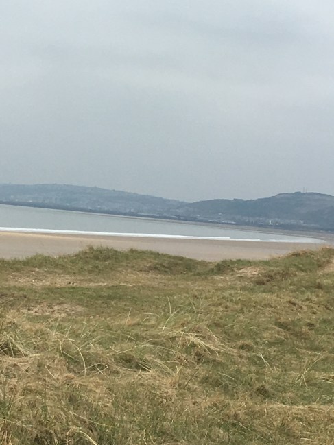
Part 4 of the chapter is Southerndown to Llantwit Major, and we did this in one (allbeit backwards) so Llantwit Major to Southerndown on 17th January 2016 as one of our first walks. A foggy start, plenty of cliffs and mud, St Donat’s castle for lunch, past Nash point and slipping and sliding for 10 miles and over 654 metres of height.

Next up is Llantwit Major to Barry, and we completed this leg on 4th June 2016, again with a lot of cliffs and fields, Abertawe power station and the famous Golden Steps – the 11.8 miles ended at Cold Knap point, and we had already completed the optional 3.5 mile Barry Island Loop on a windy 2nd May 2016.

The 6th part is Barry to Cardiff which we did in two stages, starting with Penarth to Barry on 13 March 2016 which included a steep start, the pier, mud, Sully Island, the road with never ending lamp-posts and an ice-cream to finish the 11.5 miles. On the same weekend we also did the Cardiff to Penarth part including the optional Penarth loop – it was a beautiful spring day in the sunshine to complete the 2 miles of coastal path.

The 7th section is Cardiff to Newport which we did on valentines day 2016, and it involved a Greggs (that doesn’t narrow it down much!!) the gypsy site, not stopping for food at Tescos and then regretting it when the Chef at the pub had gone home (so crisps and coffee) and the missing bridge over the railway line for a very painful 14 mile walk.

The 8th and 9th sections in the book are from Newport to Goldcliff to Caldicot, but we mixed it up and did these in 2 slightly different sections. Newport Wetlands to Duffryn was on 10th April 2016 and will be remembered for 2 things – the transporter bridge and the famous “where are the car keys?” incident, luckily it was only 6.7 miles. We also walked Caldicot to Newport Wetlands on 28th February 2016 which was a very painful walk of 12 miles, with a bit of hobbling and the Goldcliff tea rooms.

And the final leg – which ironically started off our whole adventure is Caldicot to Chepstow which we started from Chepstow and headed to Caldicot on 1st January 2016. The famous bandstand starting point (so much better than the other end in Chester), sculptures, pretty sheep, the Severn Bridge and Black Rock over 9.5 miles.

And that is our South Wales adventure – if you were keeping count that was 122 miles in total for us with the optional loops and a few detours. When we set out we said 2 years to complete it all – we were a bit out, but we will get there!!

Andrew and Sharon

Margam to Porthcawl

8th October 2017

This is another of those days when we need to join up a gap between 2 previous walks – this one is a bit more substantial though at nearly 9 miles. We have previously walked from Margam Crematorium to Aberavon Sands, and walked from Ogmore to Porthcawl, so this one joins up the gap between Porthcawl and Margam. We parked in Porthcawl and headed to Greggs for our energy breakfast. Then waited for the bus to take us to Pyle. Yes, unfortunately we could only get to Pyle so we knew we had a 3.5 mile walk to get us to the Margam starting point!!

Waiting for the bus – some paying more attention to the camera than others

At Pyle it is a walk along the A48 (which used to be the coastal path route until the bridge was built over the Kenfig river but more on that later).

Margam castle and the flag is flying so the queen is in

And within 55 minutes we were crossing the M4 and ready to start the walk proper at the Crematorium.

Over the M4 today

The new route of the coastal path goes around an industrial estate and down a lane.

From industrial estate to country lane

It then crosses both the main London to Swansea railway line (unassisted – just look both ways and run) and then a series of sidings used by Tata steel.

Look, listen and run

This then brought us out onto Margam moor, which was very flat, and involved a simple long straight path.

We were uncertain where to go when the path split, but we were right to head across a footbridge over the reed beds.

It is this way

We then came across a flooded section of path, hence why it is the moors, and for the first time in a long time we got wet socks while wading through it.

Squelching already with many miles to go

The path then became more sandy as we headed into the dunes, and the sand stuck beautifully to the muddy boots.

Sharon sets the pace

Then we arrived at the Kenfig river bridge, which was the reason why this route had been delayed from being open – if you read the 2014 edition of the Wales Coastal Path book by Goddard and Evans it says the route is still under negotiation – it is open now.

We stopped for coffee and a cake here but Sharon was more interested in playing hide and seek. As our blanket was across the coastal path we also had a runner nearly run right through us.

We can see you Sharon!!

After our rest we walked along the dune, with the sounds of motorcross bikes all around. A couple of times we had to dodge out of the way, but the glimpses of the sea made up for it.

Pink Bay gave a great view back along the coast towards Port Talbot and Aberavon.

While ahead of us was Rest Bay and Porthcawl.

The next part of the coastal path goes alongside the golf course on the boardwalk – watch out for flying balls!!

And then we were in Rest Bay, and round to Hutchwns Point.

Rest bay

We stopped at the Atlantic hotel for sunday lunch. You would not have believed it was early October, sat outside by the sea front, and the food was very tasty.

Yes it is October!!

We walked along the sea front for coffee and dessert with another view.

Who says it is all about the food!!  And then we headed around to Porthcawl pleasure beach and the car.

Today was 12.3 miles in total, and 8.8 miles of them are coastal path. This takes our total to 322.7 miles walked and 547.0 miles to go. More importantly this completes Chapter 8 of the book and all the walks of the South Wales part of the coastal path from Swansea to Cheptow.

Andrew and Sharon

Briton Ferry to Aberavon including optional loop

24th September 2017

The purpose of this walk was actually to join up a very short section between Briton Ferry and Aberavon Sands, left from 2 previous walks. But in order to make a day of it we decided to make it a circular walk taking in the red route mountainous section along Baglan as well. So we parked at St Mary’s church in Port Talbot and walked under the M4.

Red route signs

Very quickly the route began a steep climb up grass covered steps, and it just seemed to go up and up and up.

Up the road
And up the steps
Looking back from half way up
Almost at the top

At the top (over 200 floors high according to the fitbit) and the route goes along the ridge besides Mynydd Dinas forest, and gives some superb views over Aberavon and on to Swansea.

The white square factory in the exact centre of this picture is where we will be later on

Then the walk suddenly goes along a road, past a farm and you find yourself in a modern housing estate complete with school – this is Baglan. You then walk along the edge of Briton Ferry forest before dropping down sharply at the McDonalds on the Briton Ferry roundabout – which was perfect – not just to have a wee and a coffee, but also because that is where we ended up on a previous walk.

Another forest
We have been to this sign before, but this time we go left not right

You then head under the M4 and along Afon Nedd, past the Brunel tower

The underneath of the M4
The Brunel Tower

Bonnie was enjoying the river walk as we headed towards her favourite – the beach…..

Bonnie takes the lead
Baglan Burrows
Almost at the coast

Time for one final look behind us at the hill we have just climbed

And we hit the beach, to join up with the previous walk from Margam to Aberavon Sands stopping for a nice panini in the seaside cafe before running for the car in the rain.

A total of 9.7 miles walked, but only 3.7 of them are new coastal path, taking our total to 313.9 miles walked and 555.8 miles to go.

Andrew and Sharon

Ogmore to Southerndown (and back)

28th August 2017

It was a lovely sunny bank holiday Monday, and we decided to fill in our of our small gaps – this time between Ogmore and Southerndown. Only a 3.8 mile walk but we decided to leave the car at Ogmore Castle and walk both ways.

The coastal path from the castle heads across the road and on a very unused path which is overrun with stinging nettles, so we stuck to the road and the path soon found us again.

Our starting point today
Not going to be walking down here in shorts Andrew!!

Thankfully today the tide was in, so I avoided having to take Andrew on the stepping stones again as we walked along the estuary.

Fabulous views once again

Ogmore is popular any time of the year, but on an August Bank Holiday with the sun shining it was officially “heaving” and has been declared our busiest section of coastal path so far.

People everywhere

The rock formations at Ogmore are very stark but also strangely beautiful.

On the rocks
Getting more dangerous

I hadn’t spotted that Sharon had taken us off the coastal path in order to “be nearer the coast”.  I was nearly part of the coast as we walked upon a narrow ledge over a sheer drop – until I finally persuaded Sharon to head inland to rejoin the coastal path – the signs gave me the clue that all was not as it should be!!

Not going to walk round there Sharon, can we head inland?
Perhaps better to stay on the path in future

And before we knew it we were at the Southerndown car park and had joined up with our previous walk. I won’t bore you with the return journey, although needless to say it involved a stop for coffee and cake.

Total distance walked 7.5 miles, 3.8 miles of which count towards our coastal path so the total is now 310.2 miles and 559.5 miles to go.

Ogmore to Porthcawl

1st May 2017

We are getting back into the swing of it now (coastal path walking for the second weekend running), and decided to use the May Day Bank Holiday to complete another nearby section – Ogmore to Porthcawl. The advantage of completing this section was the fun fair at the end which persuaded 4 children to join us (to be fair the missing 1 was in Scotland!!).  So logistically it was quite complicated – we parked one car in PorthCawl and all got into the other car and drove to Ogmore.

Ogmore Village – free parking in a layby

It is a short walk down to Ogmore Castle, which we took a look around while waiting for the tide to go out.

Not much of Ogmore castle left
Yes there are stepping stones, but some are under water

Why did we need the tide to go out?  Because it was “easier” to go across the stepping stones than to walk a mile further in-land to find a bridge to cross over the River Ogwr. Even after our wait some of the stones were under water, and the river was still about 2 feet deep. Dan led the way across, Carys was more hesitant, but did well. The worst one was Andrew – the heavy bag was upsetting balance (honest), and “we” took about 10 minutes to get across the stones.  But no-one fell in, so Sharon lost her bet!!

Sharon giving Bonnie a helping hand across the stones

The coastal path then follows a road through Merthyr Mawr, through a car park in the woods and then down a horse track of mainly sand.

Well signposted here
Down the horse track

For about a mile the ground is hilly and sandy, and then you come out on the river Ogwr again, and can see Ogmore across the other side of the river. So this is an example of about a 5 or 6 mile detour to get across a small rivermouth.

Looking back to Ogmore
Sun cream time – Dan may have overdone it

We stopped on the beach to put some sun cream on, and for a nice cake.

Then we recreated an Enid Blyton novel – The Famous Five sit on a log.

The next few miles were then walking along the beach; the actual coastal path runs behind the beach on the sand dunes but Bonnie much prefers the sand – she even recreated the famous Cleo jump…..

Trecco Bay in the distance ahead of us
The tide was out

And before you know it you are walking alongside the Trecco Bay holiday park and Porthcawl comes into view. The little sticking out bit with a small lighthouse is worth a stroll.

A small headland
Carys looking over to Porthcawl

The coastal path then goes inland to avoid the amusement park – but we decided to detour in for a few rides.

Rhiannon and Elise in front – Sharon and Carys behind – this is before it went about 50 miles an hour and made them dizzy

Luckily the coastal path goes right by Beales fish and chip shop – the best chips in Porthcawl as the queue out the door confirms. We had to stop and taste them!!

But then it was time to do the car swap again, before the looming storm clouds started a downpour.

And it certainly did downpour

So this walk was 6.2 miles in total. We still have remaining a little 3 or 4 mile section between Southerndown and Ogmore for an evening stroll, or otherwise we would have completed from Chepstow to Porthcawl. But the 6.2 miles walked today makes 246.1 in total, and 623.8 to go still.  Roll on next weekend when we will get below 600!!

Andrew and Sharon


Briton Ferry to Swansea

19th April 2017

I can’t believe it is April and this is our first coastal path walk of the year. We have had to wait for Bonnie to be old enough and strong enough to walk with us, but over the last few weeks she has already proved herself more than ready, easily walking 8 or 10 miles and loving it.

So on our way down to Pembrey we decided to stop off and join up a little bit more of our South Wales part of the coastal path. We have gaps from Southern Down all the way to Swansea that we will pick up over the coming weeks so that soon we will have completed from Chepstow to the Gower.  So today we parked at Briton Ferry ready to walk the 6 miles into Swansea and join up with the stopping point of a previous walk in Swansea.

The start point
Over the road we go

The signs that are so familiar – left for Port Talbot but right to Swansea (we will see this sign again when we join up Port Talbot to Briton Ferry another day). And here is Bonnie on her first coastal path walk.

The first couple of miles are along main roads, with a view of the M4 and the dual carriageway into Swansea, so really nothing to write about.

Then the coastal path surprisingly takes you off the road you would normally drive into Swansea on, and towards Jersey Marine.

The M4
The other side of the M4

Turning left at Jersey Marine leads you to a lovely canal walk for about 2 miles, it is the Tennant Canal running alongside Crymlyn Bog.

Tennant canal

If it had a bench to stop for lunch then it would have been perfect but at the end of the canal we found a rock to eat our sandwiches on, and give Bonnie a well earned rest.

Time for my lunch

Then on into Swansea, over Fabian way, and past the Premier Inn, to get the marina.

Over Fabian Way
Swansea Marina

To join up with our previous walk we had to cross over the marina on the bridge and find the coastal path sign by the coffee shop….

The finish point

And then we decided that rather than walk back the 6 or 7 miles to the car we would take Bonnie on her first bus ride – but £4.30 each for a single journey – the driver must have been Dick Turpin in a previous life.

Looking out the window

So not our longest walk – 7.5 miles in total of which 6 miles were coastal path – making 239.9 miles completed and 630.0 miles to go.

A big weekend of walking in 2 weekends time will get us below the 600 mile point.

All the pictures from this walk are on the Walkies Bonnie facebook page – request access to this closed group by contacting us from the homepage of this site.

Llantwit Major to Barry

4th June 2016

We decided to stay closer to home this weekend and chose Llantwit Major to Barry, partly because it then joins up a missing section and completes the whole way from Chepstow to Southerndown, and partly because we wanted to walk early before the heat of the day.

So we parked up in Barry (again) and got the train to Lantwit Major. After a quick stop at Greggs for Breakfast we were on our way, but first we had to walk about 1.5 miles to get to the coastal path.

As seems to be the norm with our walks we had to head up a steep climb to start the coastal path walk and then we found ourselves walking for over a mile through field after field of rape seed plants and then corn on the cob plants.

There were sometimes views of the coast or an interesting object but mostly it was just fields.

The next few miles saw Abertawe Power Station get closer and closer and then just past Limpert Bay you end up walking for over a mile with a barbed wire fence on the one side and the sea wall on the other – not the best of views but we carried on and once past it we got to a nice marshland area with some ponds.

By now it was lunchtime so we stopped for our picnic on some rather uncomfortable rocks on the beach,

IMG_2611
Sharon rests her feet

Then on to Rhoose point, which is the most southerly point on the entire coastal path.

We then cut through PorthKerry campsite, where we found cabin for an ice-cream and a coffee before carrying on to the country park.

Then we hit “the golden steps” –  they were definitely steps, and lots of them, but I am not sure why they were golden!! After that a short walk across the Bull’s nose cliff we dropped down onto Pebble beach and along to Cold Knap Point.

If we hadn’t already done the Barry Island loop then at this point we could have crossed the beach at the watch tower as the tide was out. But we were able to head to the car and the end of the walk.

13.3 miles walked in total and 11.8 miles count towards the coastal path, making 164.9 miles walked and 705.1 miles to go.

Andrew and Sharon

Barry Island Loop

2nd May 2016

After a weekend of swimming galas and Sharon working on Bank holiday Monday we decided we had to sneak a bit of coastal path walking in, no matter how short – and the Barry Island loop was just the job for late afternoon on a Bank Holiday Monday with the sun shining. But how to get the kids to walk it as well? Of course – the promise of fish and chips and the amusements!!

We parked at Barry railway station, the scene of a previous start point and got our walking boots on – and some decided on a pose.

IMG_2213
Cleo points the way

We had to head down the road and across the causeway to Barry Island, and the main car park.

At the back of the car park a short walk gets you to the coast.

IMG_2220
Coast is behind Cleo and children

Although the sun was out it was quite chilly in the breeze and by now seagulls were using the breeze to stay perfectly still in the air as we headed to Friars point.

IMG_2223
Cleo flies through the air full of energy on the way to Friars point

The walk then took us along the undercover promenade where the smell of chips was too much to resist.

IMG_2228

And along the sea front besides Whitmore Bay to the climbing wall and on round Nell’s point.

We then detoured down to walk along a small beach before walking around a few backstreets to complete the loop. Time for one last pose before we headed back to the car:

IMG_2235
The elf has too many hands

Because of the location of the car, and some extra back and forwards to the amusements we walked 6.1 miles in total but only 3.5 of it counts towards the coastal path, making our total 141.4 miles completed and 728.6 miles to go. There will be a lack of updates for a couple of weeks now while other non coastal path related activities take priority.

Andrew and Sharon

Newport Wetlands to Duffryn

Today the plan was to complete part of a leg of the walk left from a previous weekend – we could not have walked any further on either our Cardiff to Newport leg, or on the 1.5 legs of Caldicot to Wetlands – so this shorter day joins up the two bits.

And what a plan we had – Leave Sharon’s car at Duffryn, Andrew then drives us both to the wetlands and parks – we walk back to Sharon’s car and then Sharon drives back to Andrew’s car – what could possibly go wrong??!! More on that later.

So at the wetlands we had to get back to the white lighthouse to resume our walk, which was 0.5 miles of walk which wasn’t on the coastal path and then off we went, following the large circluar dog walk through the wetlands.

The walk heads towards the power-station, and then ends up back through wetlands car park (2 miles done and back to the car lol), and then off across fields and through marshland.

IMG_1922
Cleo not waiting for a picture

This part of the walk felt more like a farm walk than a coastal path walk – through field after field after field, each with a bridge and double gate – which really slowed down the pace.

IMG_1928

A little past Nash Church we hit the by now typical “footpath closed” snag:

But this time we were able to climb along the outside of the bridge quite easily as there was no gap to jump across. Suddenly the coastal path joins bike route 4, and becomes much smoother for a mile.

At this point (and I don’t know why) I decided to check Sharon had her car keys ready for the end of the walk. Quite calmly Sharon said that she had left them hidden from view – in my car!! It took about 5 minutes for Sharon to convince me that she wasn’t joking and was really that “special”, but eventually I was convinced and phoned Mum’s taxis to be at the end of the route to drive us back to Wetlands.

The next part of the walk went quite industrial, walking on a narrow path on the edge of the river Usk, until you reach the Newport Transporter bridge. We decided to cross using the bridge (the roast lamb was in the oven after all!!):

IMG_1942

Then a short walk along the SDR and turn down towards Pill and the YMCA, then pass by Argos, through a tunnel and there is the car (minus keys):

IMG_1945

Luckily, next to the car was mum to drive us back to the Wetlands.

So a total of 7.2 miles walked in 2 hours and 1 minute, 6.7 miles on the coastal path, making the total 99.4 miles walked, and 770.6 miles to go. And we have now walked the entire section from Chepstow to Barry!!!

Margam to Aberavon Sands

Well it is the first day of Spring and we have decided to increase the pace and start walking some weekends with the kids as well (well some of them at least) – might be harder to convince the big ones!!

The compromise on this route was that because most of the walk coincides with national cycle path 4, the kids were allowed to use bikes (plus with them riding ahead then coming back they did even more miles) and it allowed Cleo to get a ride part of the way.

So we parked up at junction 38 of the M4 by Margam Crematorium and walked towards Aberavon Sands – this isn’t a single leg in the book we are following – but the end of the Porthcawl to Port Talbot route, and the start of the Port Talbot to Swansea route, so it will make both of those legs a bit more manageable in future weeks.

IMG_1407
Cleo getting ready in her basket

We soon found the coastal path sign (along with the alternative red route which goes through Margam park) – do we have to walk that as well in the future to say we have done it all lol?

The first couple of miles really are not anything to write a blog about – So Cleo stayed tucked up in the basket with Rhiannon navigating.  Here is a selection of what we saw!!

Then you end up on the main road to Aberavon and past a new blue cycle bridge, and along an estuary which is when it starts getting more picturesque and Cleo got to stretch her legs and walk for a few miles.

You head up a slight hill, and suddenly notice sand on the path and as you walk around a corner – bang – the most amazing views:

The walk along the sea front is beautiful (as long as you don’t look behind you towards the industrial area) and we stopped for hot chocolate and cookies on, of all things, a whale!!

IMG_1435
I’m queen of the whale
IMG_1436
Sharon chilling with the penguins

We decided to walk a bit further, so that when we resume this walk another day we can cut down from Baglan station, so it meant walking as far as the kids could cycle before the path diverted in land.

IMG_1437
Taking in some art (or trying to scale it)
IMG_1440
What a view!!

And that ends the coastal path element for today 6.5 miles done, making 63.5 miles completed and 806.5 to go.

But we had to get back to the car – so in a first for us, we had to then walk back again!! After a stop to play on the beach of course:

Nothing much to say about the return journey, pretty much the same as the way there and thankfully the kids rode a bit slower (until they got a couple of mini magnums inside them!!).

But it was good for us to have pace setters to keep us moving – according to Strava the total was 22.1 km (which is 13.7 miles in total today), and we managed it in just over 3 and 3/4 hours. Definitely getting fitter which is a good thing with all the walks we have got planned in the coming weeks, sometimes back to back as well – might have to take the kids again.

Andrew and Sharon

%d bloggers like this: