12th July Amlwch Port to Cemaes Bay

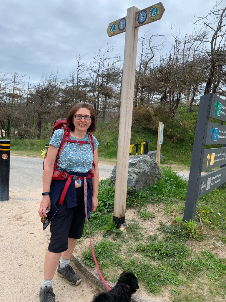
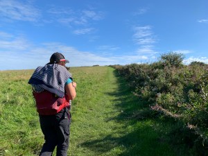
Not the longest walk today but quite a hilly one, and we were at the campsite entrance at 8am to flag down the bus. Almost 45 minutes later and we are at Amlwch Port, last seen when we started here and walked to Moelfre back in April 2019.

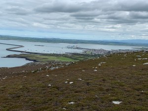
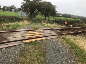
First task – find where we left off last time….. there it is, right in the middle of the port area.

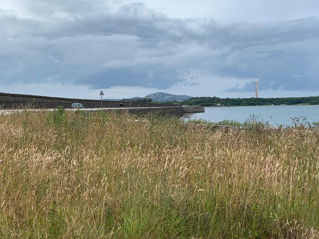
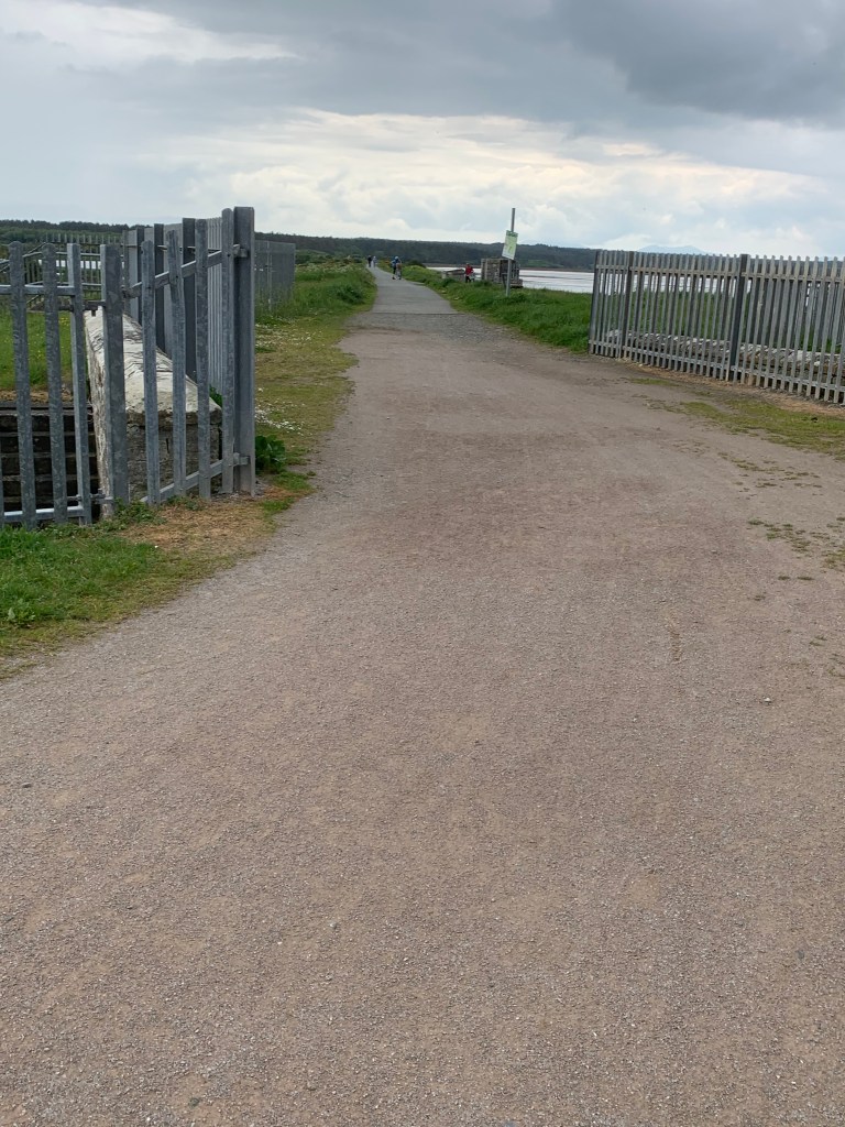
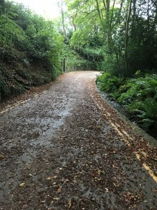
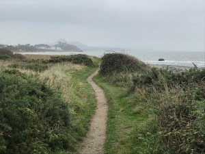
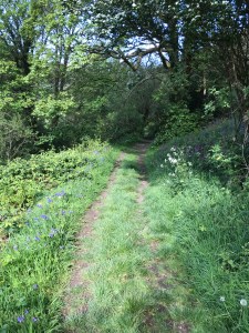
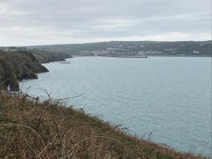
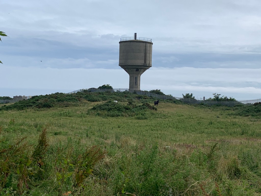
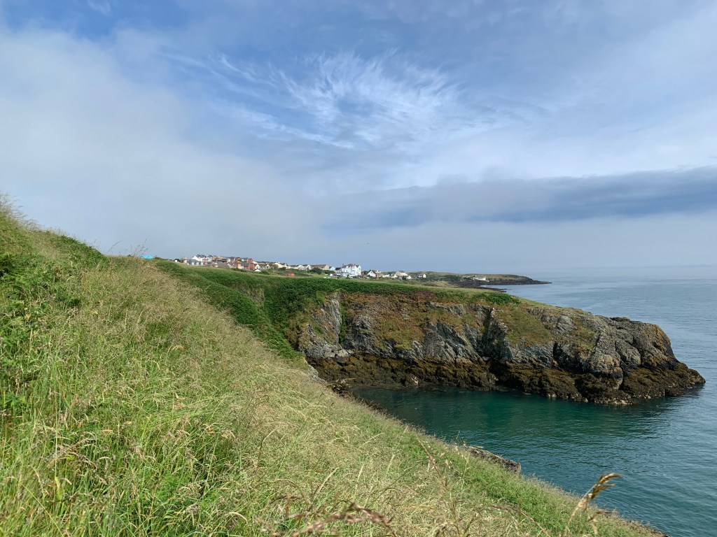
After a mixture of road and grass we made it to the coast, and looking back behind us we could see the water tower.

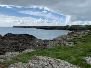
This little island is Ynys Amlwch not surprisingly named, but we continue left along the coast.

The early part of the walk was quite low down, and we were wondering when the height would start to come into play.

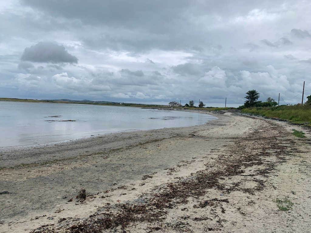
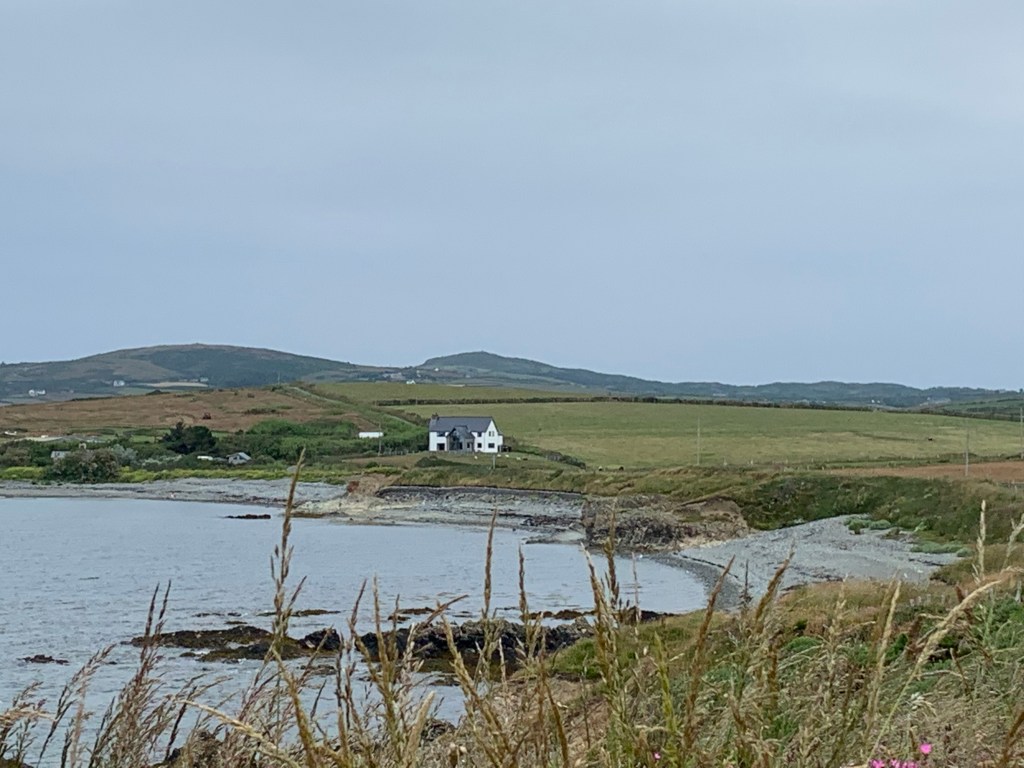
Behind us was what looked like a prison but was actually a Bromide extraction plant which closed in 2004. Ahead of us we could just make out Bull Bay, which hopefully would be a stopping point for breakfast as we left without any this morning and there was nothing obvious in Amlwch.

Strange cloud formation over Bull Bay

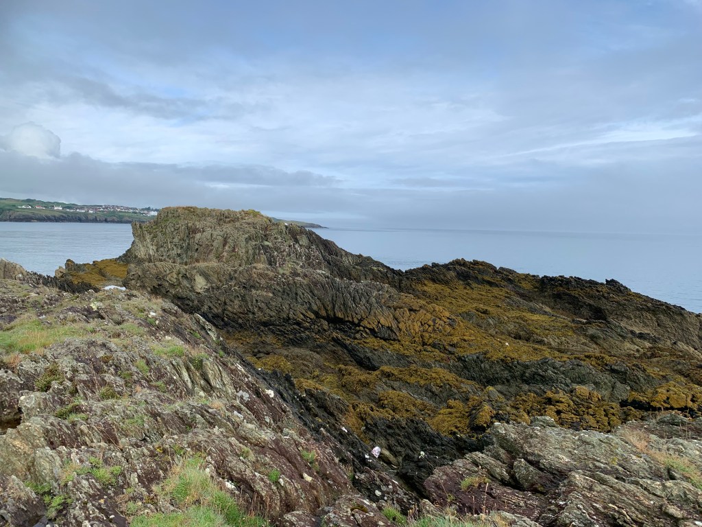
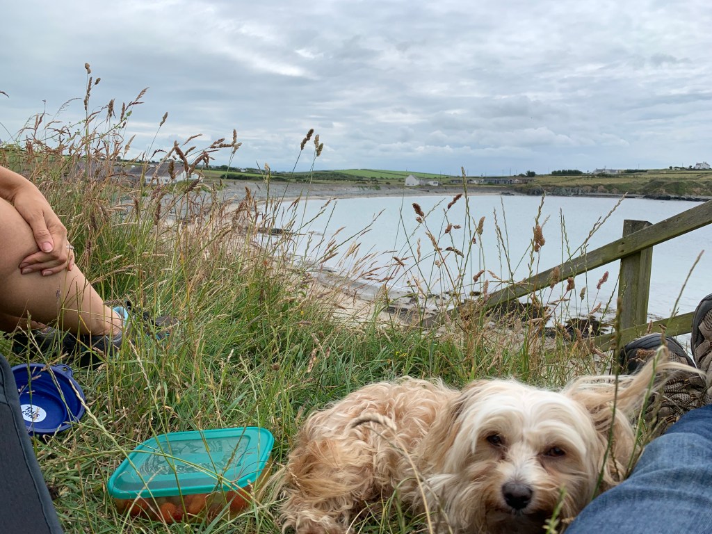
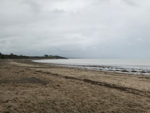
And here is Bull Bay, one sign suggested a hotel had breakfast, but it was all boarded up and there are no cafes here, so they are definitely missing a trick. Oh well, we decided to have part one of lunch instead and hoped we could find more lunch later somewhere.

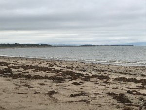
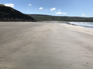
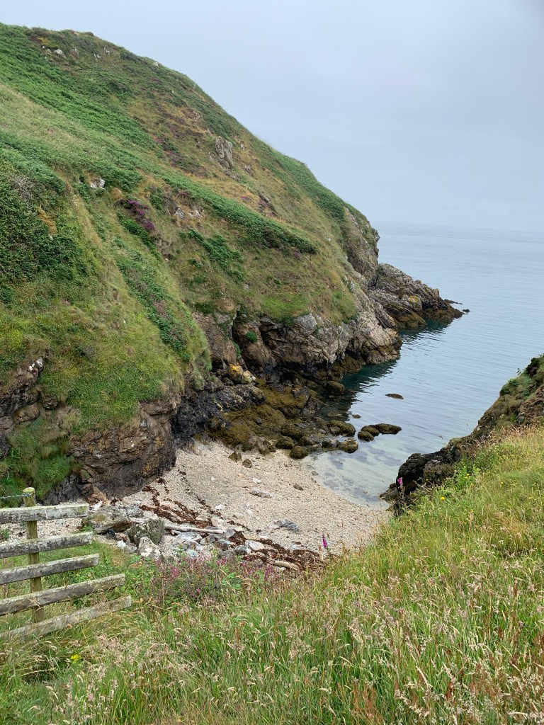
This part of Bull Bay is known as Traeth Dynion, which in Victorian times was the beach for men, with the women’s beach about half a mile further along – that would have stopped naughty goings on!!

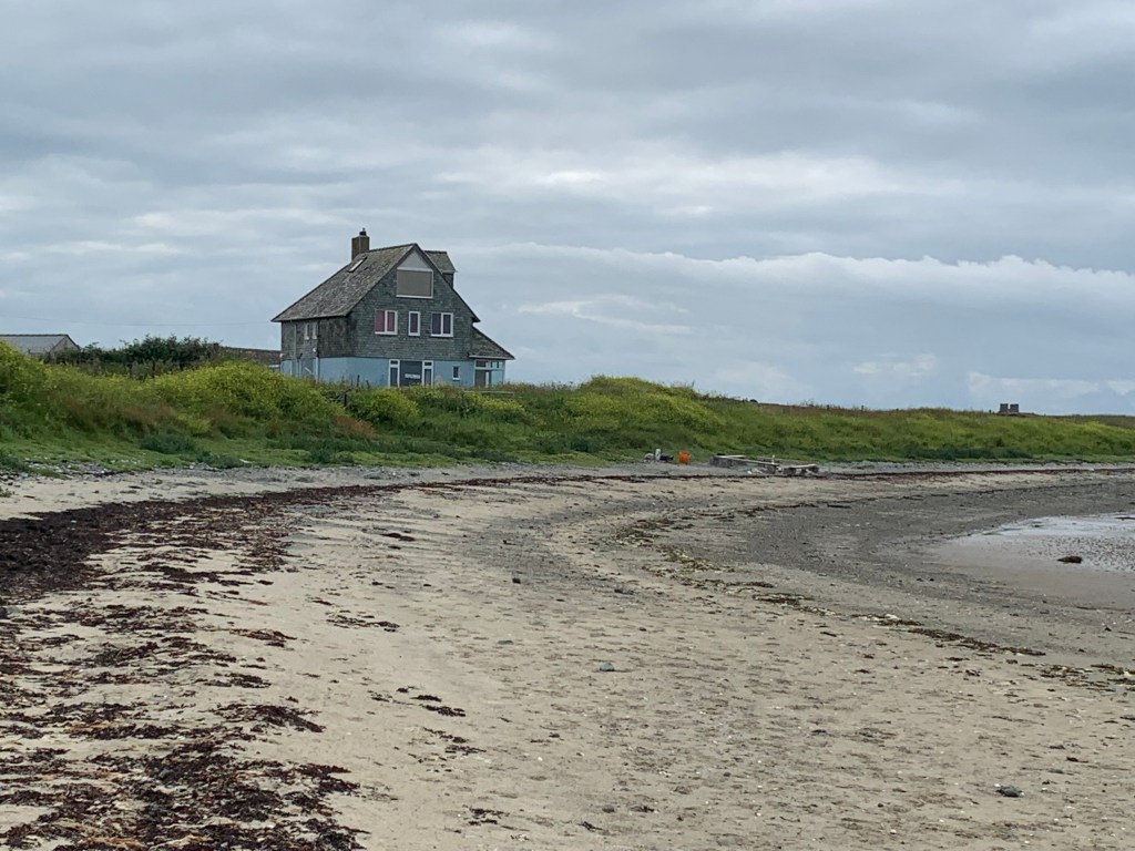
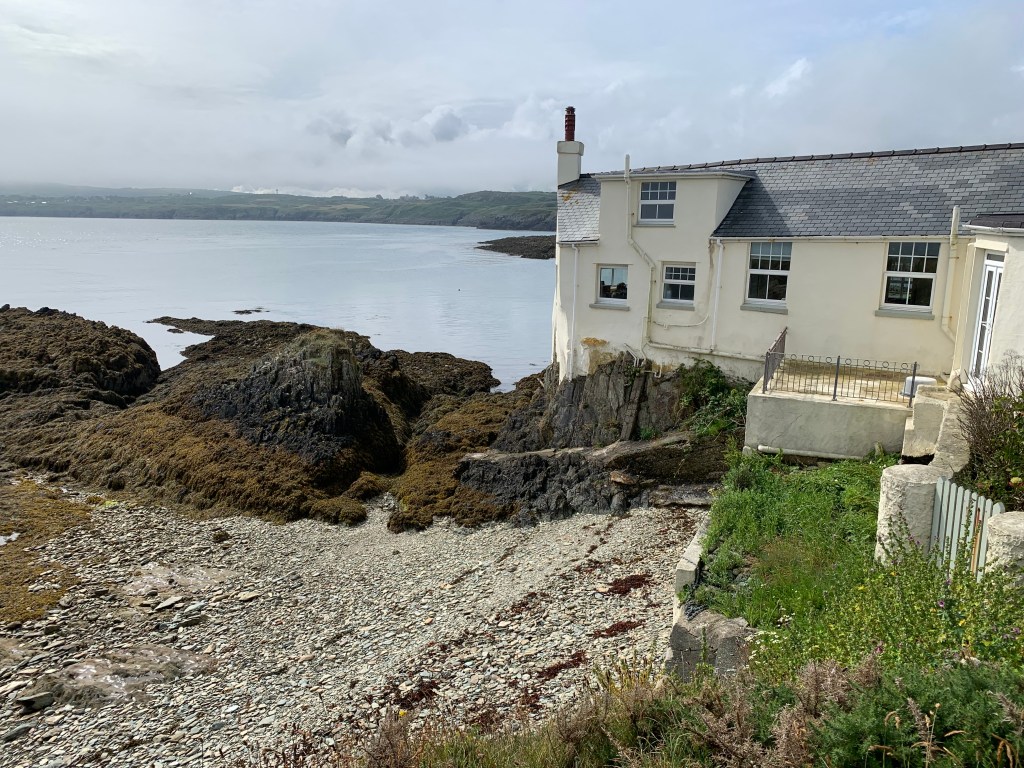
How about this for a house built out of the rock – couldn’t be much more on the coastal path really.

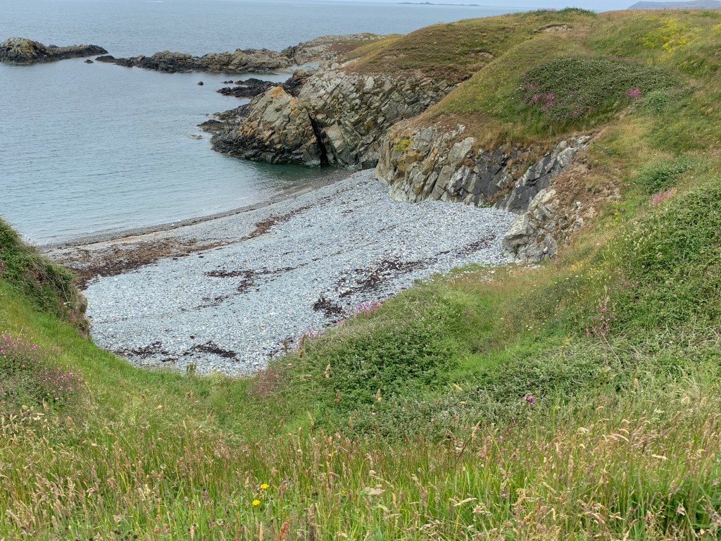
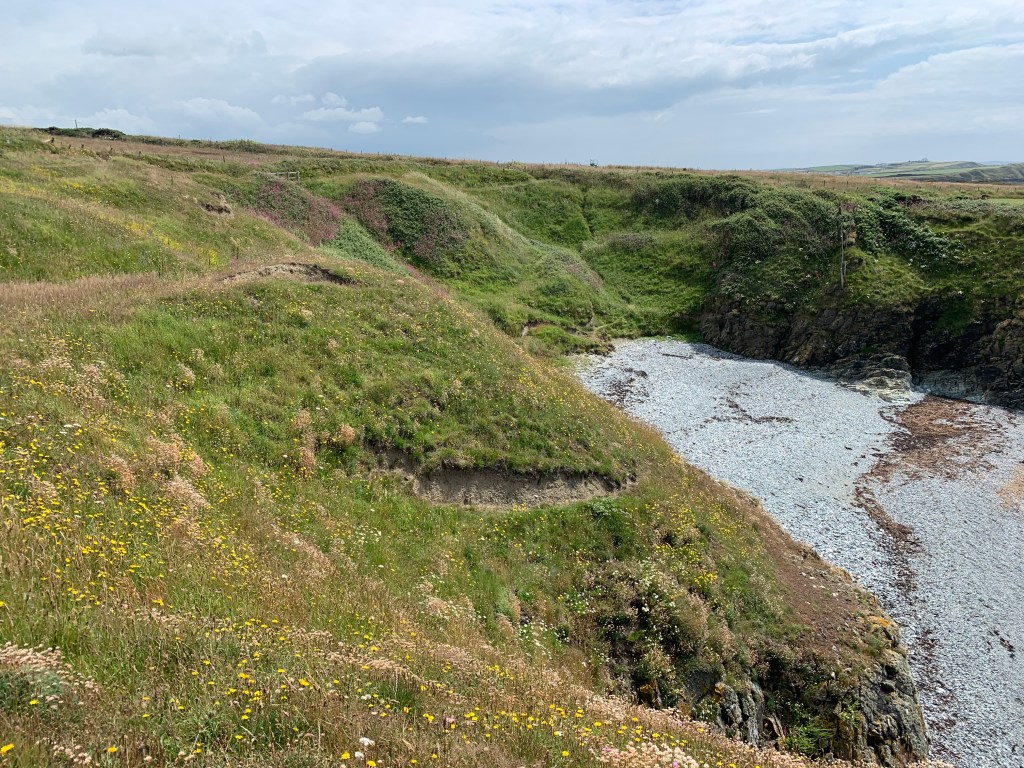
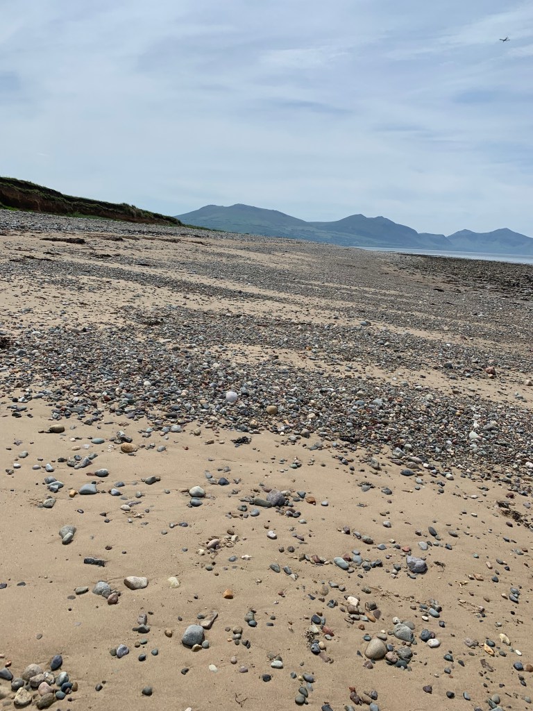
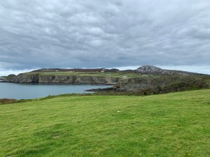
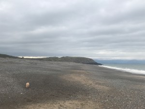
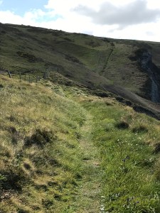
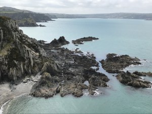
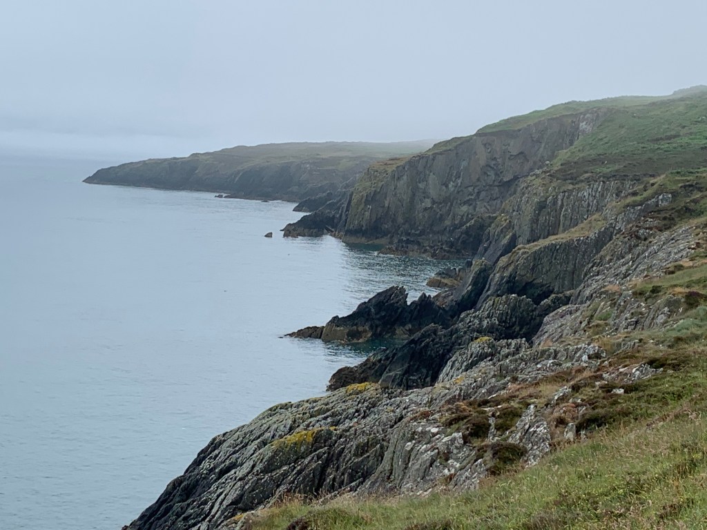
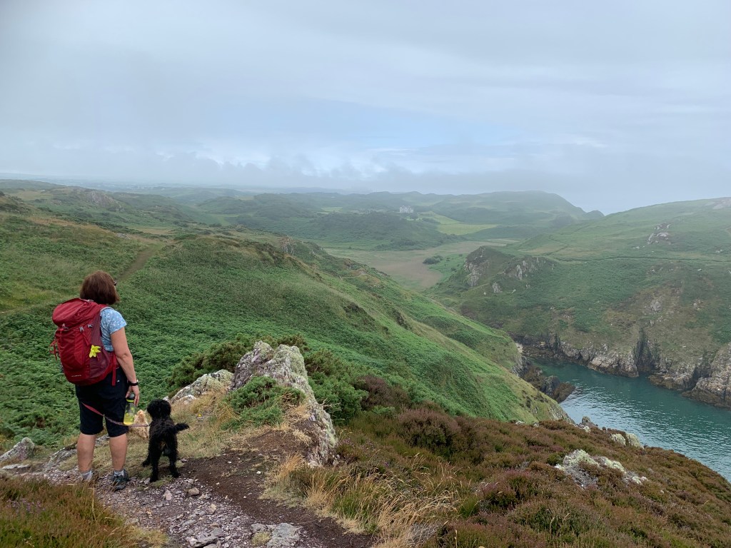
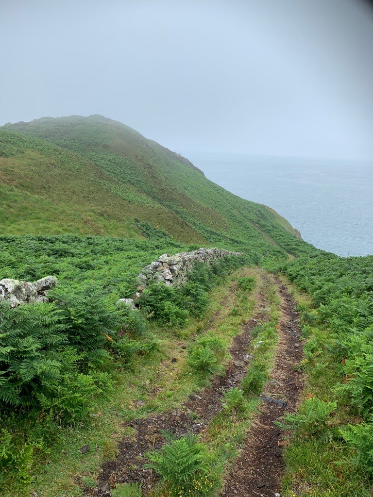
We now started to get some height in us as we walked in and out of several coves towards Trwynbychan.

I’m not good with heights so took this picture from way back and long arms.

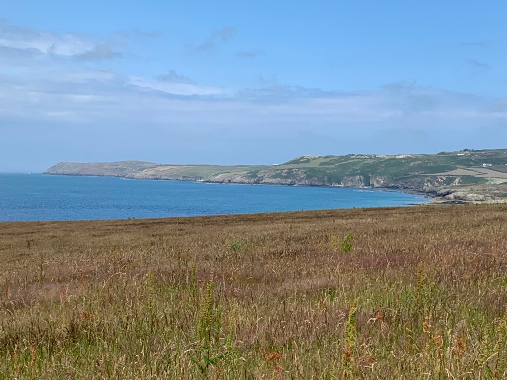
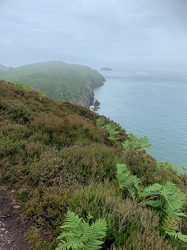
A quick look back to the slightly less hilly morning section as we now started some more serious climbing.

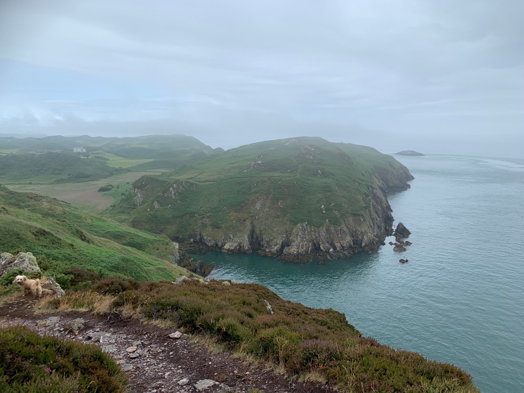
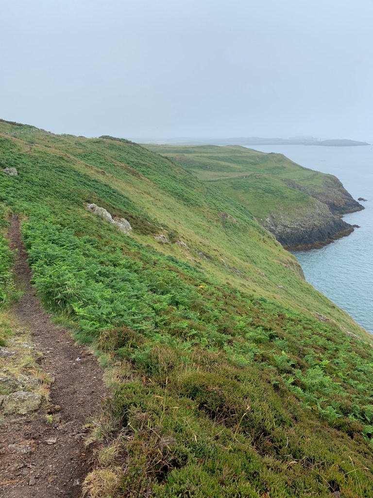
As we rounded Trwynbychan we seemed to be almost in the clouds.

A left turn took us inland and across Porth Wen we could see the old brick works, which has a series of beehive kilns and it’s own dock to export bricks, but no roads in or out and hasn’t been used for some time.

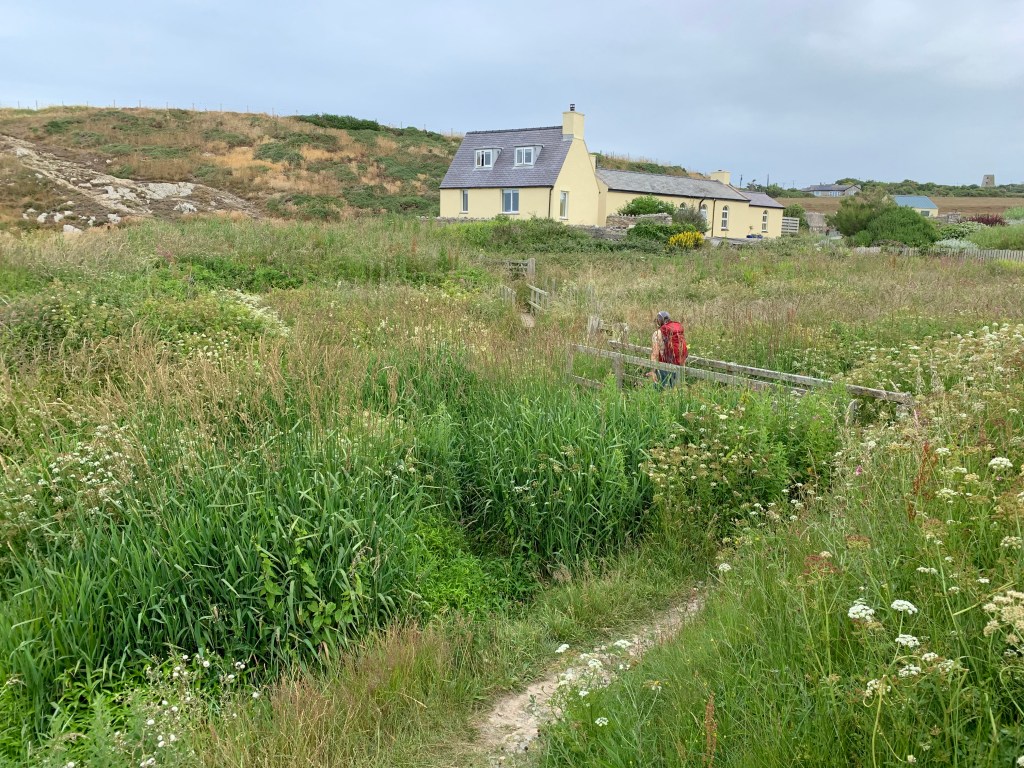
The coastal path passed right through the garden of a cottage at sea level and then up again through some fields behind the brick works.

Looking back at Porth Wen

And in the centre of this picture is the very top of the brick works chimney.

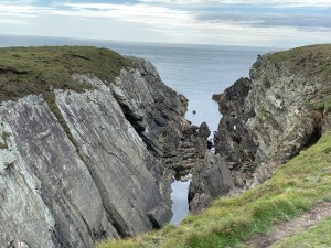
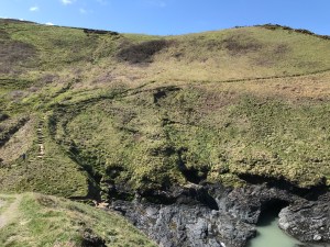
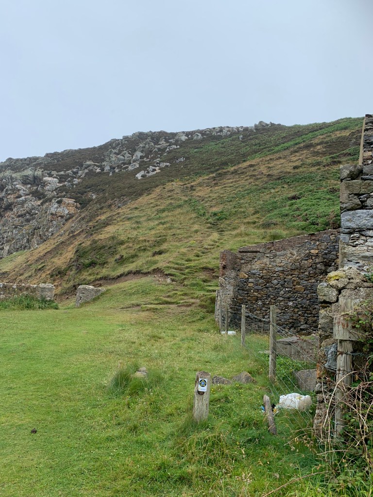
The route then kept climbing, just look how high we were now… and then bent left through the great quartz quarries which fed the brick works.

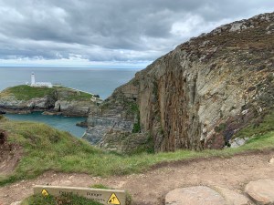
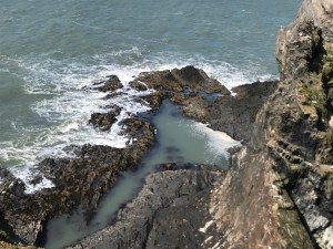
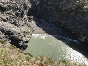
That is the aptly known Hell’s mouth.

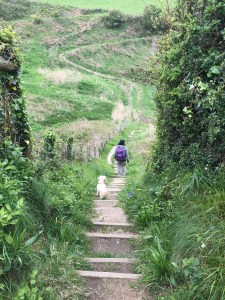
And that is my lovely wife taking a look at Hell’s mouth and enjoying the view before we almost certainly had to descend to ground level and back up the other side.

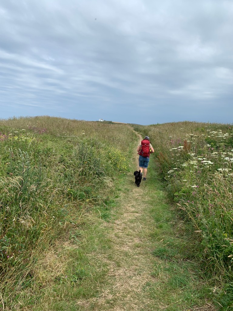
How well we know the coastal path by now, yes there goes Sharon down the steep steps and looking ahead there is the climb back up the other side again.

This is Hell’s mouth from the inside 😉

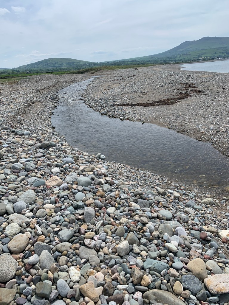
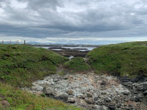
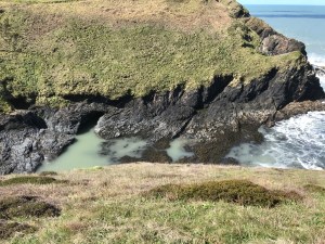
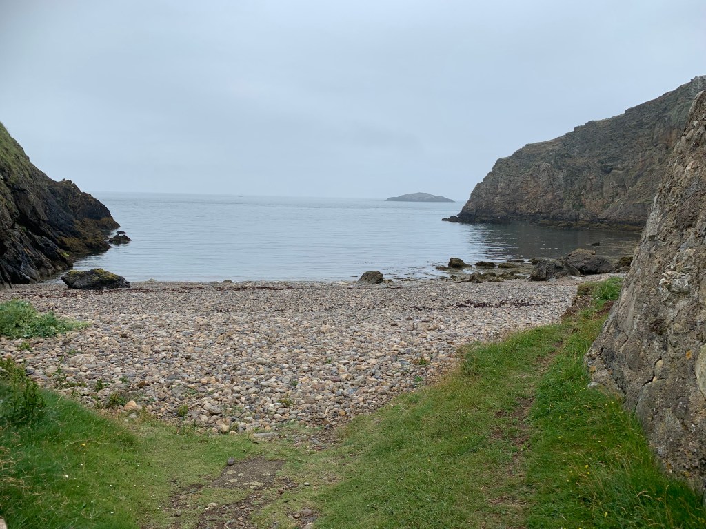
After another the descent on the other side of the next climb we reached the Clay works at Porth Llanlleiana where porcelain was made from local china clay until 1920.

The Clay works

The hill we came down to get to the Clay works.

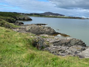
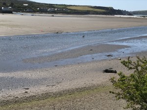
Porth Llanlleiana and Yyns Badrig in the distance.

According to the guide book we follow “the path continues to bound along the joyful undulations of the coast” – that wasn’t quite the phrase we were using by now, and we weren’t quite bounding.

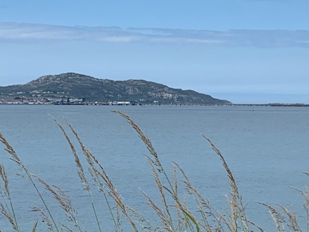
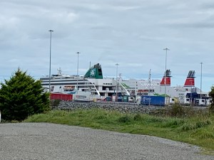
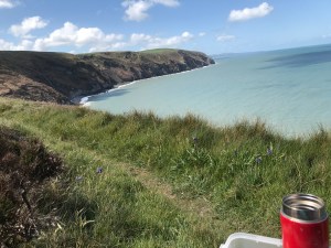
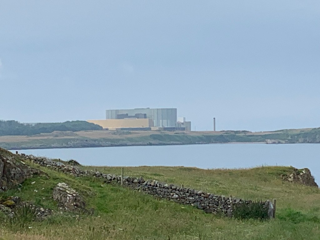
In the distance is Wylfa nuclear power station which is tomorrow’s walk, so we knew we didn’t have far to go today.

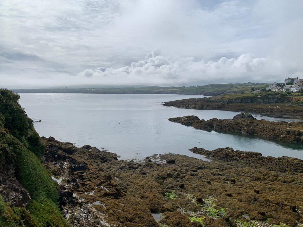
Sure enough we rounded another jutting out bit and Cemaes Bay was almost in sight,

First we passed the church at Llanbadrig where St Patrick is said to have founded the church after being shipwrecked on the way to Ireland.

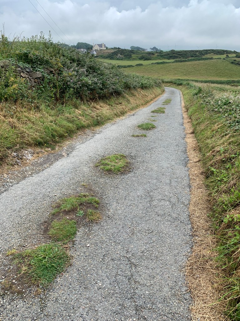
Then down a lane and along some narrow paths as the power station loomed nearer.

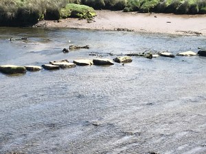
A quick look back to Porth Padrig (which you can walk on at low tide if you fancy even more rise and fall).

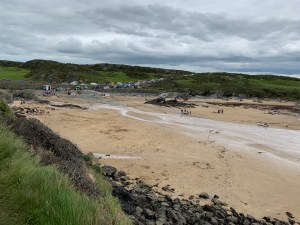
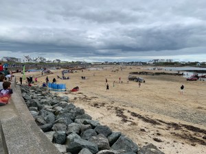
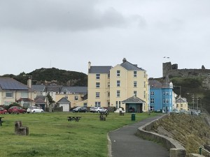
At this point Cemaes bay appears from nowhere and Sharon, who by now is very hungry (it is 1pm now) does a quick google to find that a) there are no decent places for lunch and b) there is a bus in about 20 minutes which goes right back to the camp site.

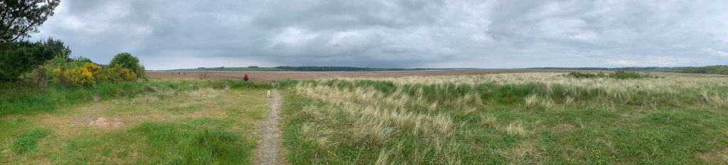
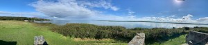
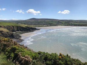
So after stopping for the obligatory panoramic photo…

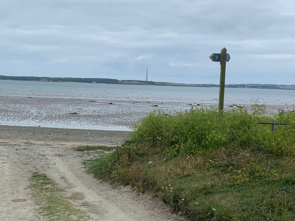
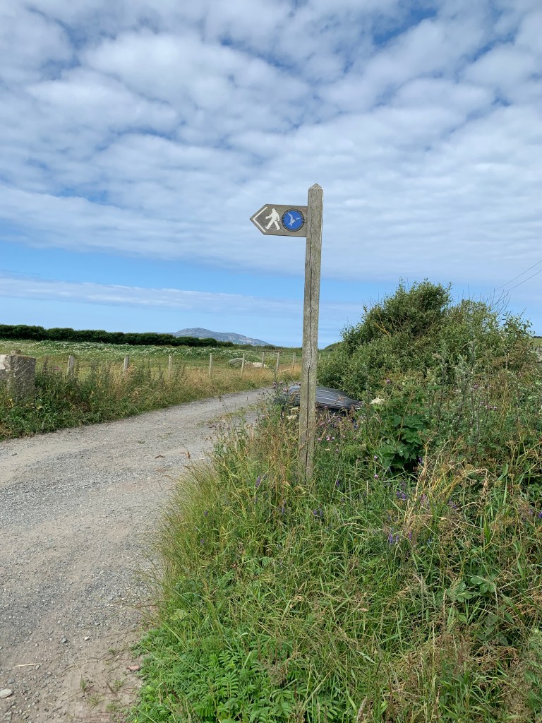
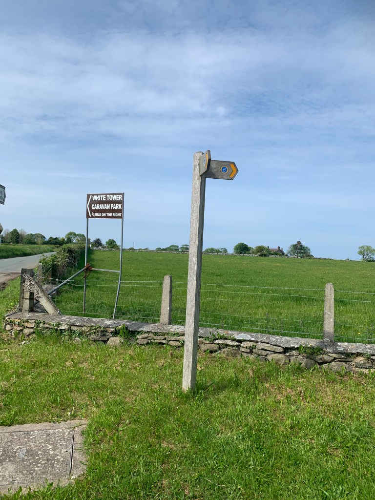
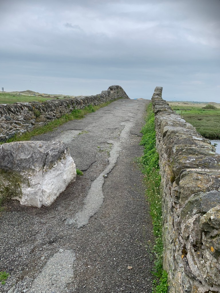
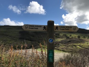
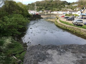
we headed into the town and across a blue bridge which marked the end point of today’s walk…..

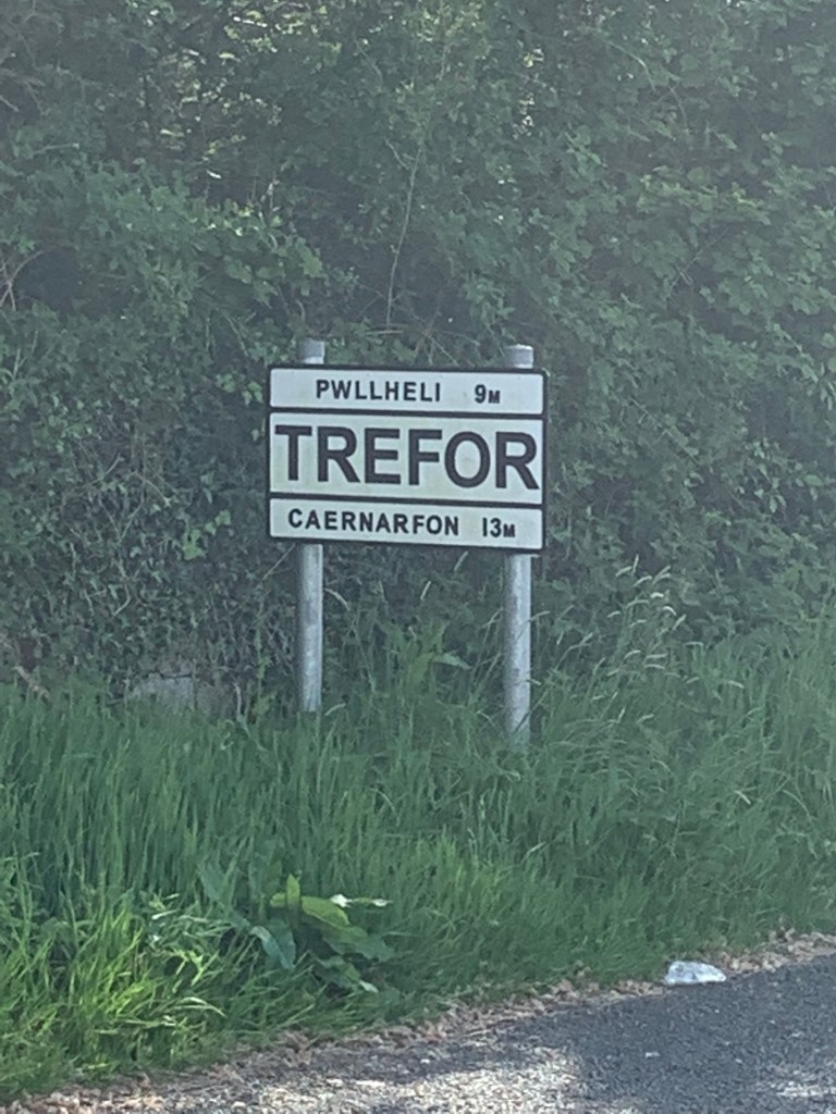
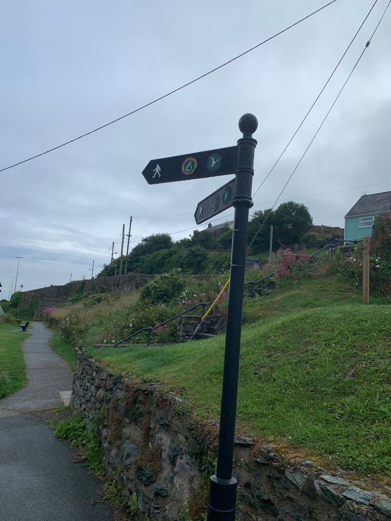
or to be more precise this sign does.

So a good day’s walking and back home by 2.30 for a late lunch/early dinner. 8.1 miles walked today, making 681.5 miles walked in total and 206.3 miles to go (depending on whether you look at what’s left in the book or subtract the miles walked from 887 miles in total). I think from now on we have to go with the miles left on the walks we have to go to be clearer otherwise we will end up in negative numbers. So from tomorrow we will do that, and what a walk we have to finish the weekend – 11 miles and 410 metres in height.

10th-11th July 2021 Stanley Embankment to Church Bay

Another long weekend, and the furthest possible drive to the top of Anglesey (185 miles) for our 4th walking weekend on Anglesey and this time we are going to finish the island off.

We had already completed a small part of the Porth Swtan (Church Bay) to Holyhead section, and had left about 10 miles still to do. With no buses running on a Sunday and with our campsite halfway between the Stanley Embankment and Church Bay, we decided to walk both ways from Llanfwrog to Church Bay on the Saturday and likewise from Llanfwrog to Stanley Embankment and back on the Sunday.

The beach by Llanfwrog, the start and finish point for 2 days

I’ll start by describing the Sunday walk down to Stanley Embankment.

The beach is a not the best along here

We started off along the beach, and got so carried away that we missed a sign which would have taken us off the beach and inland to avoid the river – we just carried on enjoying the views 🙂

At the end of the beach you reach the mouth of river Alaw and have to turn left and go inland.

The tide was out but even still there was too much water to get across the estuary without the bridge, so now we have to rejoin the coastal path.

Once back on the path it went through some grassland, and then through the middle of a corn field. The threat of rain never far away – we set off early today as we know rain is due between 1 and 2pm. This detour won’t have helped our cause.

And then, after a coffee and cake break, the bridge came into view.

Sharon and Lola pick up the pace

Without this bridge the walk would be a further 1 mile in and out of Llanfachraeth to get over the river, so thank you bridge.

Unfortunately the other side of the river is not a well walked bit of the coastal path, and the brambles and stinging nettles were quite high in many places.

But with some walkways

And there was even a bit of a bridge/wall to walk along.

Gorad Beach

For the last bit of the walk the coastal path takes you in through the housing estate, but actually we could have stayed on the beach, as we found out on the way back.

Here is the Stanley Embankment (and that Chimney again that we were forever seeing on Holy Island) and the end of today’s walk – except it isn’t as we now have to walk back – hopefully a bit quicker if we don’t get lost.

Back along the beach

Back through the brambles….

But this time we found the right path and got back more quickly, so this was a 10.7 mile walk in total, but the way out was 5.7 miles and the way back was 5.0 miles which is the figure which goes towards the coastal path total.

This write-up now moves on to the Saturday walk – which is again from Llanfwrog to Church Bay (and back again). And for the first time I can reveal how we keep the dogs fresh before and after a 10 mile walk – we let them ride in luxury from the campsite to the walk start…..

Bonnie with her head up and Lola (black so you can hardly see her) hanging out the right hand side, and a brown paw out the back, crazy dog

Here is the starting point, the same sign as we finished with yesterday.

but this time we walk up the track and turn right through a gate and up through two fields of cows.

and down the other side towards the first beach of the day.

Across the water we have a great view of Holyhead port and the large ferries going to Ireland.

The path then heads right through the middle of a working farm and along a road which goes through the middle of a campsite at Porth Tywyn-Mawr.

Sharon and Lola lead the way again

After climbing the steps off the beach we decided to stop for lunch and a snooze (the snooze was Bonnie). Lola meanwhile decided to bring back various sticks and flowers for us to look at.

We then walked along Porth Tredadog and up the road beside this house.

The rest of this walk is then mainly clifftops and small beaches down below.

Bonnie finds a bit of energy to chase Lola for a change and we head up to Porth Trwyn.

The coastline then shows about 4 or 5 jutty out bits (to be technical) ahead of us but actually Church Bay is before most of these, and they are to be saved for our walk on Tuesday.

Over a little bridge…..

past Porth Crugmor…..

and we find Church Bay.

With a lot of people looking out to sea.

For those undertaking this route, there are no shops in Church Bay, but there is a lovely Cafe called the Wavecrest which does meals and drinks Friday to Monday and then has a coffee and cake van Tuesday to Thursday.

This is Porth Swtan, Church Bay.

After a drink and an ice cream we turned around (5.1 miles completed) to do exactly the same walk back again – with some different views and photos on the way back.

Now that must have been a big wave

And talking of waves – here is Sharon with Lola having a paddle on Porth Penrhyn-Mawr.

Back along the cliffs, through the campsite and the cow fields to the finish point.

And even better -the bikes are still where I chained them this morning. Today was 10.2 miles, of which 5.1 miles counts towards our coastal path total.

That makes 10.1 miles across the two days to finish this section and for our grand total it now makes 690.1 miles completed and 214.4 miles to go, although if you add up from the walks left we still have 226.7 miles to go which just shows how some walks are longer than the book says.

1st June 2021 – Saron to Trefor

So we leave Anglesey behind for the last day of walking and pick up on a walk we started two years ago when we walked from Caernarfon to Saron (as the means of trying to reduce the length of a future walk). The whole walk should end up at Clynnog Fawr but, for reasons which will become clear later, we ended up walking another 3 miles to Trefor. So after a local bus to Saron (£1.60) at 9.45 am we reached the start point of today…

The walk heads down a lane and, after a left hand bend, we walked down a holiday let drive, along a grassy path, through some woodland and reached the coast.

This area is very much tidal marshland and a bridge over the river Carrog took us onto the embankment and towards the airfield and Fort Belan – which was bizarrely built in the American war of independence and, unsurprisingly, has never seen action.

The airfield houses an air museum (closed today) as well as being the home of the Wales Air Ambulance.

It also has a long sandy beach leading for over a mile to Dinas Dinlle, which has the basics of a toilet, cafe and fish and chip shop -but we have our lunch in the backpacks and need to start lightening the load.

At this point the official coastal path heads inland and along a road (for the entire rest of the day). Sharon wasn’t keen on this, and we studied the maps for some time before concluding that we had to cut inland further down the beach in order to get over the river Llyfni but, other than that, there was only one “small” river which hit the beach about 1.5 miles along, and if we could cross that somehow we could then exit the beach at a campsite and join the main road.

So with some worries in the back of my mind of how big this river was, we set off along the beach.

We made it to the river, and spent quite a while surveying the best place to cross – higher up the beach it was narrow but deep and fast flowing – nearer the shore it was much shallower but spread over a wide area. Different approaches came into play …..

Sharon decided to “go for it” and took a run and jump at the middle, but didn’t quite clear it and ended up with one wet foot. Andrew went for the slow and cautious approach and threw large rocks into the shallow area as stepping stones, but ran out of rocks and ended up with two wet feet!! We stopped to dry off, have a coffee and change our socks before heading through the campsite to get to the main road (A499).

And there isn’t much more to say on these 2 or 3 miles, we just walked along a busy road, sometimes the coastal path left the road slightly to follow the old road, but it was village after village till we got to Clynnog Fawr. This is the end of the walk in this chapter of the book. But looking ahead the walk continues on this same road for another 3 miles at the start of the next walk, and getting that out of the way now means that a future walk (which goes over those mountains you have been seeing in the photos all day) will be less painful with its 650m of climb.

So we took the chance to have a rest and have a look around St Beuno’s Church – which stands on the site of a 7th Century monastery founded by St Beuno. There is also a wooden chest carved from a tree.

While we were stopped, the bus that we wanted to get back home later (there is one an hour) stopped outside and we decided to try to get on now rather than do the extra walk. But unfortunately this particular firm (without any warning on their website) decided that they no longer take dogs so we couldn’t get on the bus. We decided to instead carry on with the walk as planned, and then get a taxi back from Trefor later on. So, in the heat, off we set, now carrying Lola as she was getting too hot and tired.

Our next point of interest was St Beuno’s well, which was said to cure epilepsy and eye problems, but I wouldn’t risk drinking the water!!

There were some beautiful views along the way to Trefor even if we were mostly walking along the main road. But the top left picture does show the mountains we have to take on during the next leg of this journey.

We arrived in Trefor just before 6pm and found a store for an ice-cream while awaiting our taxi back to Caernarfon.

So the total today was 13.2 miles of coastal path (and across the whole weekend that makes 43.1 miles completed which is excellent with a new puppy). We have now completed 664.2 miles and have 211.4 miles to go. I’ll leave you with some pictures of the sun setting over Anglesey from Caernarfon.

29th May 2021 – Aberffraw to Newborough

Finally our coastal path walking in 2021 can get underway with lockdown restrictions eased enough for us to be able to stay overnight and have a shower!! We set off on a wet Friday knowing that the weekend was going to be glorious weather. We have a new puppy now, Lola, who is a 15 week old Cockerpoo, so some of our walks will be shorter than usual as she adjusts to the distance. Today we parked in Newborough and got the bus (£3.10 single each) to Aberffraw.

Th

This was our starting point, having previously walked the other way from Aberffraw to Four mile bridge. We started by crossing the river Ffraw and then walking along it’s sandy shoreline to Aberffraw Bay.

After about a mile on the beach the coastal path has to leave the coast as rights have not been negotiated to walk across the headland in front of us. So over the dunes we went, across a road and then through 2 fields full of sheep as we headed up towards a farmhouse before turning left.

We then walked across various fields, and past a derelict farmhouse to get to the main road, and then had to walk 2 miles or so along the road to get to the village of Hermon.

After the village of Hermon we were supposed to find a path leading us to walk along the river for a while, but the path was nowhere to be seen so we continued on the road to the next village, Malltraeth, where Sharon had earlier spotted a cafe on our bus ride. The Riverside Cafe and tea garden – and a very nice cafe it was too with delicious homemade cakes. Thankfully this also put us back on the coastal path.

After a nice lunch we headed across the river Cefni and along the Cob which is about a mile of raised pathway built 200 or so years ago to claim land back from the tidal river. We then entered the lovely Newborough Forest which reminded us of Pembrey Country park with sand dune and pine trees. The paths crisscross all over the place but as long as you keep the sea on your right then you are heading the right way. The first chance to try to get across the marshlands to the beach was flooded out, so we continued through the forest and then climbed over a sand dune and down onto Penrhos beach.

We then took a small detour to see Ynys Llanddwyn, the home of St Dwynwen’s church – the Welsh patron saint of lovers and it is said that all newly weds should visit here to bless their marriage – well we have been married 18 months so not quite in that category but there has been a lockdown you know!!

Back to the coastal path now, and along Llanddwyn beach to the far end where there is a large car park (and toilets). We then walked over Newborough Warren; said to be called this because there used to be masses of rabbits, till myxomatosis struck in the 1950s. The edge of the forest brought us out to a much smaller car park with a weird sculpture (hopefully our base for tomorrow), and then up to the main road where it was a short walk to find the van and cook the Spag Bol for tea.

Time for the stats – we walked just over 16 miles today of which 15.3 miles was coastal path. That takes us to 636.4 miles walked and 239.2 miles to go. Lola was really flagging by the end, so we will split the next walk into two parts and do it over 2 days.

The Meirionnydd Coastal Path

Well this is one of the shortest chunks of coastal path at just 61.4 miles, and 5 sections, but it also contains the 2 hilliest sections on the whole coastal path at 620 metres and 600 metres of climb.  Here are all the walks of this section in order:

Llanbedr to Penrhyndeudraeth – 12.9 miles completed

Llanbedr to Fairbourne – 15.0 miles completed

Fairbourne to Tywyn – 16.0 miles completed

Tywyn to Aberdyfi – 4.5 miles completed

Aberdyfi to Machynnleth – 13.0 miles completed


Holyhead to Trearddur Bay

Sunday 30th August 2020

So a long bank holiday weekend in Anglesey to try to complete 3 more of the walks on the big island off Wales. We arrived on the Saturday and did a few miles of the 2nd walk, but more on that later, as today we set ourselves a mammoth challenge for our first coastal path walk in 10 months:

The plan was to bike 2.5 miles from the campsite to a spot near the coastal path, and then walk a total of over 20 miles, not all of it coastal path as we needed to finish up where we started (no buses today), and then bike back to the campsite.

Our start point

The starting point for the walk today was Four mile bridge, not named because it is 4 miles long, far from it, more because it is 4 miles from Holyhead. The coastal path headed along the side of the estuary across some very marshy and muddy land to get to the only other way to cross to Holy Island, the Stanley Embankment.  It would be easy to get lost here as the signs go both ways, up towards Church Bay or left to Holy Island – left it is today.

Along the path

Great views of the estuary

Over the railway line and you are on the embankment and walking besides Holyhead Bay and into Penrhos Coastal Path.

Penhros Coastal Path

There was then a bit of a climb up to a viewpoint.

Up we climb

But the views were worth it

We then walked along the cliff tops….

and on to see the ruins of a naval battery used as a defence in the Napoleonic War.

Selfie time

and then around a football pitch before dropping into Holyhead itself and along a residential road, past the port and the railway station.

Hunger was setting in by now, and we found a nice little cafe which was serving breakfast still at 11.30am, the Beach Hut Cafe.  A nice stopping point,  and I got to count the lorries coming off the ferry (I’ll claim for the time later) and then off we went again up out of Holyhead and past the breakwater.

A strange concrete shrine

You will notice from the pictures that we were climbing all the way now and there is a good reason for that which came into view as we rounded North Stack and got sight of Holyhead Mountain, the highest point on Holyhead.

It really was this steep

And we really were this high – that is the town of Holyhead in the distance

The walk doesn’t quite hit the peak of the mountain – and if we weren’t doing 20 miles today and we weren’t socially distancing from the crowds, then we might have made the small detour to the summit, but onwards we went with the downhill part now, and the approach to South Stack lighthouse.

Just time for Bonnie to pop to the loo….

Toilet break – is this the ladies?

Unfortunately due to the pandemic South Stack lighthouse wasn’t open to the public today, but it did save us a fair few steps:

South Stack Lighthouse

We continued the descent and took a wrong turn, following a coastal path sign in the wrong direction, but a swift U-turn and we passed some amazing rock faces:

Can you see him?

Zoom in closer and you will – I am sure this is cheating though!!

Here he is

Ellin’s tower, a folly, was also not open so we walked down a step road to Abraham’s bosom – no it is just a broad bay – and a good place for a late lunch.

Ellin’s folly

Abraham’s bosom

The coastal path then continued to hug the coast line from on high, and the landscape became more and more moon like.

Bonnie on the moon

Stunning landscape

You pass a beautiful beach with a suitable toilet stop…

Porth Dafarch

The last part of the walk kept us walking along a road with no pavement, then deviating off to the right down the path to the coast, then back left to the road at least 5 times….it would have been less distance to stay on the road, but never mind as the sight of Trearddur Bay was worth the walk.

Finally our end point

Well actually Trearddur bay might have been the end point for today’s coastal path but not our walking; we still had 2 miles to walk back to the bikes and 2.5 miles to cycle!!

One last look at the beach

Thankfully we found a nice pub on the walk back and had a cider and a delicious meal, before getting back to the campsite very tired but full. Over 20 miles walked and for the record that was our longest single day ever.  16.7 miles of coastal path takes us to 562.4 miles completed and 312.8 miles to go still. And another walk tomorrow.


Llanbedrog to Criccieth

5th October 2019

We had planned for this walk to be on Sunday, rather than today, but because it was a flatter 15 miles and we could start earlier than the other walk (there is rain coming in around 1pm) we decided to head out early today to do this one.  So we left the campsite before 7am and were parked in Criccieth by 7.15am.

The same view as yesterday but today it is dark still

We headed up into the town which was about 0.5 miles and got on a bus to Pwllheli, and then had a 30 minute wait for the 2nd bus to get us to Llanbedrog. Even after all that we were still walking by 8.50am, and we started by getting down onto the beach.  I’ll say up front that this walk turned out to be a long walk but without too much of interest with long sections of beach and then long sections of road.

The road down to the beach

Llanbedrog beach

The beach itself has a cute line of beach huts and a mixture of sand and stone.

We missed the first exit from the beach but the book told us there was a second way up, so we took that and got around the Carreg y Defaid headland, and along to another long beach which was very rocky at Traeth Crugan – there was a path which ran parallel to the beach but behind a water defense and we used that for over a mile as it sheltered us from the wind.

2nd time lucky

Looking back to what should be tomorrow’s more hilly walk

The coastal path then headed inland around Pwllheli harbour and almost right past the bus stop we had waited at a bit earlier. We kept up the brisk pace today (with the threat of rain later) and 4 miles in and we decided not to stop at Pwllheli but instead carry on around the harbour and out to the Morfa Abererch after nearly 2 miles of road walking.

Pwllheli sea front

Pwllheli Harbour

And out on to the beach

This beach seemed to go on forever, but in reality it was about 2 miles, and then we approached Pen-ychain which was another rocky outcrop.

Pen-ychain

Bonnie found the stones difficult to walk on so had a helping hand as we left the beach.

That’s the life

We then decided to take a quick break, which was probably the latest we have ever made a first stop coming after 2 hours 40 minutes and almost 9 miles of walking. A quick coffee and sandwich, and a snooze for Bonnie then off we set again.

Time for 20 winks


We passed a teepee and walked around the hillside and some narrow woodland paths

The path then went through some shrubland ……

following the coast and then took a left inland. At this point we got lost as we assumed we would be turning right and following the coast again but that was private land, so we had to turn around and retrace our steps and head about 0.5 miles inland to follow the coastal path till it hit the main road into Criccieth (the A497).

I would like to say the day was all like this – yes over there in front of the peak is Criccieth castle if you look closely.

But sadly we had over 2 miles of this to follow with cars going past at 60mph

Finally the path turned right at a farm and angling centre (shown by this sign which wasn’t completely obvious).

Don’t miss this one

And we headed through the farm, across some sheep fields and over the train tracks.

Which brought us to some very marshy and muddy land where we had to jump from stone to stone – if the tide had been in we could have found this part very difficult.  By now the rain had also started so we were desperate to get to the end – the castle was our marker all the way.

The easier part of marshland

And then it got harder

Finally our path came back parallel to the sea, if very slightly inland from it.

One of us was still cheery, but it was raining on the other one of us.

What rain? Sharon is still smiling under there

Finally as we headed around a corner the car came into sight.

Even the backpack has a coat now

What a view – no not the castle, the white car which means we have finished.

So at 1.45pm we finished exhausted after quite a pace,and 16.7 miles walked, of which 16.1 miles was coastal path. That takes our total to 532.8 miles walked and 342.4 miles to go.  Another long walk again tomorrow if we recover in time.

The complete Ceredigion Coastal Path

The 5th May walk completed the relatively short Ceredigion section of the Wales Coastal Path.  6 walks for a total of 72.6 miles and gaining over 2810 metres in height.

For us the walks were

  1. Machynlleth to Borth  16.1 miles and 590 metres high on 25th March 2018
  2. Aberystwth to Borth 5.7 miles and 320 metres of height on 23rd March 2018
  3. Aberystwth to LLanrhystud 11.3 miles on 26th March 2018
  4. New Quay to Llanrhystud  14 miles on 5th October 2018
  5. Aberporth to New Quay 13.3 miles on 6th October 2018
  6. Aberporth to Aberteifi 12 .2 miles on 5th May 2019

Moylgrove to Newport Parrog

4th May 2019

Today is another day where we have already done part of the walk – so although in the book the walk is from St Dogmael’s to Newport (Parrog) we have already walked from St Dogmael’s to Moylgrove (with the kids, well the other way from Moylgrove to St Dogmael’s actually) so today is now slightly easier.

We drove to Parrog car park and waited for the bus. This has to take the record for parking close to where the bus picked us up from. This bus only runs on a Thursday and Saturday in low season, and adds a 3rd day per week from the end of May.

Yes that is the car outside the bus window

And a first for Bonnie – her own ticket

The bus dropped us, and quite a few other walkers, in Moylgrove village and we knew it was about a mile to get to the coast. The others all set off while we were still getting ourselves sorted and it took a while for us to find the woodland path to get to the coast but it was a lovely walk with a stream running below us and plenty of spring flowers.

Then suddenly we appeared at the familiar sight of Ceibwr Bay and the walk proper could begin.

Ceibwr Bay

The first landmark is Witches Cauldron, which is a collapsed sea cave.

Note the arms in shadow – I wasn’t getting any closer to the edge so had to reach up for the picture

A little further along the path dropped to sea level but on the left was a beach with the tide going in and out right underneath us.

Of course, after going down we had to then climb the other side, for some further magnificent views including Bwn Bach which is a small perfectly formed archway and then along the top of Traeth Cell-Howell.

We reached a spot where we could see a further drop ahead of us and then a massive set of steps, and decided that this would be a good spot to stop for lunch to build up the reserves for the climb.

The lunchtime view

Before this climb

High above the beach

We had a couple more descents to sea level and climbs back up again, including a chance for Sharon to re-live the stepping stones experience.

Careful does it

And then the sight of Newport Sands appeared around a corner.

Newport Sands

A very steep descent followed…

and by now the coats were off, the sun was shining and the sky was a deep blue – typical walking weather for us.  Newport Sands came ever closer.

The path then dropped almost to the beach before frustratingly going back up again, so at this point we decided to do a little bouldering and get ourselves down onto the sands and enjoy the beach.

What a stunning beach

After a coffee and cake stop we headed across the golf course, and followed the river inland to get to the bridge.

With the tide out we were able to see the Pilgrim’s stepping stones, which we had made a pilgrimage of our own to see previously.

Over the “iron” bridge

The walk then continued back along the other side of the river to Parrog.

And to the car-park where we started. A day of contrasts and beautiful weather, and 9.2 miles of new coastal path for us with over 215 storeys of height.  For those keeping score (like me) that makes 494.2 miles completed and 381 miles to go (roughly)

Newport (Parrog) to Fishguard

3rd May 2019

This weekend saw us take on 3 walks, complete another section of the book, pass the 500 mile point and join up some parts of walks we started 3 years ago.

So as usual we started the weekend with a drive – this time just over 2 hours to get to Fishguard, and we parked up right by our caravan site in time to get the bus to Newport (Parrog). We have been here before when we undertook the Dinas Loop and then drove to Parrog in June 2016 to see the stepping stones, but this time we are heading towards Fishguard.

After getting off the bus at Newport, and walking down a side road we reached the yacht club and a familiar starting place – had it really been 3 years since we sat in the cafe garden having an ice cream here?

Our previous trip to the stepping stones had started here

The tide was out

The old lifeboat house

The old lifeboat house was built in the late 19th Century but only in service for 11 years before being replaced.

After a flattish section past some cottages the walk started to climb and hugged the coast line as we went around Aberrhigian Beach and Aberfforrest Bay.

Looking back towards Newport Bay

And Newport Sands

Sharon sets the pace inland towards Aberrhigian Beach

Aberrhigian Beach

At some point around here I lost my drinks bottle, but didn’t realise until about 5 miles later and Sharon didn’t want to go back for it!!

Crossing over Aberfforrest Bay

After a short further walk along the hilltops you arrive at Cwm-Yr- Eglwys, again a part we had visited 3 years ago as part of the Dinas Head loop.

The 12th century St Brynach’s church which got partially washed away in 1859

And then one of my least favourite signs of the whole coastal path….

Noooooooooo!!

It was this sign 3 years ago which made us realise that Sharon had left Cleo’s lead at Pen y Fan on Dinas Head, and gave me the pleasure of doing the walk to the peak for a second time in one day…. but today we have Bonnie’s lead so we are okay, and we quickly navigate the flat path as by now it is coffee time.

Pwll-gwaelod and coffee time

The sun has now come out and the skies are clearing, wish we had brought sun-cream after all!! I am going to let some of the pictures do the talking now on this stunning part of the coast as we rounded Pwll Cwm, then Pwll Gwylog, Aber bach and Aber Grugog.

Stunning views, and now for a dose of reality, time for a selfie….

Say cheesy – and also a rare glimpse of Sharon’s hat before she lost it the next day

The path then had a sign warning of deep holes, but the animals who had created these very deep holes had very thoughtfully done so between a set of posts each time – very clever.

Watch your step

One of the offenders

The walk continued on hill tops past needle rock and towards Fishguard fort.

We have decided that Needle Rock should be called crocodile rock instead:

Or is it just me that can see a crocodile head at the bottom of the picture!

That was a steep descent

What can I tell you about Fishguard Fort – well it was built in the late 18th Century to protect Fishguard after an attack from the Black Prince, a pirate ship demanding a heavy ransom. This was the last attack by pirates on any town in the country but the fort’s heavy cannons saw off the French and instead they landed further down the coast – oh well, that’s someone else’s problem!!

After the fort there was a brief woodland section and then you had to join the road to walk down into Lower Fishguard.

Lower Fishguard

The walk crossed the bridge and then turned right along the estuary before starting a climb. That is where we stopped for today as going on to Goodwick would have taken us away from the car – so here is the sign to pick up from on a future walk.

The end point of today

10.7 miles walked today, of which 9.2 miles counted towards the coastal path. That takes us to 485.0 miles completed and 390.2 miles to go. Time to find the caravan and relax before a longer walk tomorrow.

%d bloggers like this: