Mumbles to Oxwich Bay

24th February 2018

Our first coastal path walk of 2018, and it’s going to be long one. We started off with a drive to Swansea where we left the car strategically close to a bus stop for later. We then biked the 5 miles down to Mumbles pier and a nice breakfast.

Ready to bike with Bonnie in her basket
Our breakfast view
In a dog friendly restaurant, so Bonnie was very excited

So at 10.25 we set off from the restaurant and headed up some steps to Bracelet Bay and Mumbles lighthouse, before passing Rams Tor and Limeslade.

Up up and away
Rams Tor

There was then a nice new concrete path to take us towards Langland Bay, but not before a rather steep climb up steps.

More steps – a theme of today
A few of the outcrops we will pass today
Langland Bay

And on we went after stopping for a not particularly nice cup of coffee at the Surfside restaurant. 2 miles later we arrived at Caswell Bay, at which point we had to take to the road as the tide was in.

After some more climbing we reached Pwildu bay, with a stream running to the beach and a bridge to cross over the river.

Climbing up through the woods from Pwildu Bay we met a fellow walker – who was walking from Mumbles to Southgate for the 2nd day running (his phone had told him to walk 208 miles this month apparently, and he listened to it!!).  We chatted and walked for a while but we were clearly slowing him down so we said our farewells and he headed off into the distance……

Our fellow walker heading off into the distance

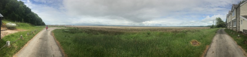
We then headed towards Three Cliffs Bay and a stop for lunch at the halfway spot.

We then dropped down a steep sandy path (glad we didn’t have to walk up it) to a flood plain and stepping stones.  Now anyone who has been following our adventures will know that Andrew has had issues in the past with stepping stones – but not today – all the practice paid off and Andrew cleared them without stopping.

Sharon lagging behind

After walking past Great Tor on the cliffs we knew we could drop down to the beach to complete the walk to Oxwich Bay.

Great Tor

And that was our 12 mile walk, done by 2.45pm.

The end of the walk, joining up with the previous walk

But then we had to wait for the bus, so we popped into the hotel for a nice afternoon pot of tea, and very reasonably priced as well.

Then up the hill for a mile to the bus-stop.

And we got the 118 back to Swansea and the car, and then off to get the bikes.  12 miles completed taking us to 336.7 miles completed and 535.0 miles to go.


Oxwich Bay to Rhossili

19th August 2017

On a dry but very windy day we decided to walk in the Gower from Oxwich Bay to Rhossili. We had wanted to include the walk out to Worm’s head but the tide times and the bus times wouldn’t coincide – so we parked in Rhossili and got the bus to Towers.

The sign at Rhossili where we will end up
Sharon and Bonnie at the bus stop
Towers – with the road leading down to Oxwich Bay

We walked down the road to Oxwich Bay and found the coastal path sign before walking along the beach front.

The sign at Oxwich beach
Oxwich Bay

We passed St Illtyd’s church before starting a very steep climb and descent (apparently to avoid a landslip – so the book tells me).

Up we climb

And then we walked around Oxwich point and along to Lucas Bay.

Port Eynon in the distance
Lucas Bay

We had decided to stop for lunch at Port Eynon, and found ourselves walking both against the strong wind, and against 98 two person teams completing a run/swim from Rhossili to Oxwich – so on narrow parts we had to stop and let them through. We also found that part of the path had fallen into the sea so needed to detour inland and back out again.

Doh – lunch is delayed

In Port Eynon we got some cakes at the Life Boat open day and sat down to eat them when we heard “Dad!” “Sharon!” and saw Dan with his head stuck through a hole receiving a lot of sponges in the face – he was running the stall for the life boaters.

Dan enjoying a soaking

After Dan showed us the sights of Port Eynon we continued up and around to Port Eynon point.

Port Eynon beach
The Salt House
Port Eynon Point

The walk then follows the coast all the way to Rhossili – but boy is it hilly. We walked over Overton Cliff, Common Cliff, and Horse Cliff, and the altitude was clocking up.

Fabulous views but very hilly
A great coastal path sign
And the wind was whipping up the sea into a froth

In the sun it was very warm, especially up the hills.

So trendy
Bonnie leads the way
More stunning scenery

And we picked the best view of the day for our afternoon coffee and cake.

Cake tastes better with this view

We set off again having refueled and finally we could see Worm’s head in the distance.

There’s Worm’s Head

By now it was about 4.30 and we had been walking for over 12 miles, but we pushed on up a few more hills to walk around the top of the cliff above Worm’s Head and to Lookout point.

Sharon Looking out at Look out point
Rhossili Bay for another day

And we had made it back to Rhossili- A harder day than I had thought it would be, but then I was only just recovering from a night of being sick 30 hours earlier. There are more photos on the Walkies Bonnie Facebook page.

The total walk was 14.9 miles, and 14.2 of that was coastal path – and the total height gained was 2,076 feet.

Our grand total now is 306.4 miles walked and 563.6 miles to go.

Pen-Clawdd to Llangennith (part 2)

2nd June 2017

Back in April 2016 we completed part of a walk in the Gower, from Pen-Clawdd to Llanrhidian. The whole walk actually ends in Llangennith and, without the kids this time, we decided to tackle the rest. By the time we had finished lunch and waited for the rain to stop it was 2.30pm when we started.

Down the hill to the start point

So the starting point was to walk back down the hill into Llanrhidian, which felt a lot better than the walk up it did last year!!

The first couple of miles don’t feel particularly coastal as they are mainly through woodland.

Sharon and Bonnie in the lead

We got distracted by a castle up on the hill above us and thought the coastal path also went up this steep hill…..

The picture doesn’t do this hill justice
But the castle was worth the climb

but despite the lovely view of Weobly Castle (one to come back to with more time), it was the wrong way and we ended up going back down the hill again.

We then hit Landimore Marsh which was our first sight of the coast today and thankfully the tide was out so we had no risk of wet feet.

Bovehill is on the marsh
Storm clouds still brewing

We even stayed dry over the stepping stones as well, despite a wobble from Andrew.

Simple stepping stones this time!!
The marsh gives a great 180 degree view

We had planned to do the Burges Island optional loop so turned right rather than left after Burry Pill but then we were faced with a diversion.

Sharon did consider ignoring the signs and going on, but the picture next to the sign suggested that about a 15 foot long section of sea wall was missing and it would have been one heck of a jump to get across. So we followed the diversion through a nature reserve and came across a fantastic little craft shop and cafe called Cwm Ivy Coffee Shop.

Bonnie sampled the treats

The view with our tea and cake was fantastic and, once refreshed, we walked down the hill to the beach.  In hindsight we should have stayed at sea level as the tide was out, but the climb to the top of Hills Tor was worth the effort when we saw the views.

Best views of the year so far across Broughton Bay from the top of Hills Tor. The path then passed by a campsite and among Delvid Burrows before climbing again to Blue Pool Corner and the small island of Burry Holms was ahead of us.

Worms Head in the distance
Burry Holms

From here it is a pleasant walk along Rhosilli Bay Beach to Llangennith.

Thor’s hammer in wood
The tide was out on the beach

And then a walk up the road to Hillend campsite where the path continued right, but we had to go left to end this leg and head up the road a mile to get the last bus of the night back to Llanrhidian (7pm and £3 each for those who may need the information in the future).

So the total walk was 13 miles, of which 12 miles was coastal path, making 292.2 miles completed and 577.5 miles to go.  This day had something of everything and was a wonderful afternoon out.


Pennard Cliffs to Swansea (First and second parts)

11th June 2016

This particular leg of the coastal path is going to be done over a few weekends – not because it is challenging, but because we have just under 2 hours each Saturday that Rhiannon swims in Swansea, which gives us the scope to walk about 3 to 4 miles one way and back again to the pool (which is in the centre of the walk).  So this week we walked west towards the Mumbles as far as we could in the time permitted, with 2 kids on scooters while 1 swam, 1 worked and 1 sat in the car lol.

The walk itself is all tarmac path and very flat so it was easy to walk 15 minute miles all the way. And within 45 minutes we had made it to the mumbles. I started taking pictures on the return journey. But first for the bribery….

It was a cloudy day and Swansea Bay did not look it’s best as we passed West Cross and Black Pill. The kids scooting ahead and then playing on the various exercise machinery.

We won’t count this towards the coastal path until we have completed the whole leg – but for the record today was exactly 7 miles of walking in 1 hour and 45 minutes and of that 2.9 miles counted towards the coastal path. Further updates to this blog to follow as we fill in the gaps on the walk.

25th June 2016

Part two of the walk had the same starting point, but this time we turned left towards Swansea, and despite the weather saying no rain – it was raining!!!

IMG_2821
Walking in the rain

We headed along the sea front, with the ominous clouds ahead but plenty of people out and soon the rain stopped.

The walk takes you round to the marina and then across a bridge which opens and shuts to let boats in.  For today that had to be out stopping point before we turned around and walked back.

So that was 3 miles more towards the total coastal path making 186.3 walked and 683.7 to go.  Still time for a quick pose and an ice cream later on of course!!

Andrew and Sharon

Pen-Clawdd to Llangennith (part 1)

The full Pen-Clawdd to Llangennith walk (including optional Berges Island) is 17 miles, which is a little beyond our single day best so far. So with the caravan sited down here and the kids ready for another biking adventure we set off to nibble at this leg by walking from Pen-Clawdd to Llanrhidian, leaving a more manageable walk for another day (another of Sharon’s good ideas of course).

So we parked the car where we finished on Saturday and set off down the alley…

IMG_1749


We had another first time walkiescleo child with us today having persuaded Elise to join us (the promise of fish and chips at the end) and she chose to walk with us rather than take her bike with the other kids.

IMG_1750


No sooner had we set off though and we hit the first snag, the alleyway was flooded and impassable, although the kids on bikes rode through it ok.


This gave us an idea, and as the kids had wellies we got them to ride back, give us the bikes and we rode through while they waded back…Cleo also got a swim…You can see the remains of Andrew’s first plan, the bridge of sticks, at the bottom of the 3rd picture lol.

The walk then quickly hits the salt marshes, which are very boggy, but also very picturesque, and luckily it wasn’t high tide so it was easy to walk along.


But not always so easy to ride along….

IMG_1762


And then my favourite comment of the day from Elise. On the marshes are a lot of ponies. Cleo decided to have a poo right besides a massive pile of horse poo, So Elise calls out ‘can I have a poo bag please dad?’. My response….’Which one are you picking up first?’.

IMG_1767


Anyway, on we walked and the pace was good at just over 16 minutes per mile, although Elise was running at times to keep up. We saw another very smart house…

IMG_1770


With Cleo photobombing!! Along here were various tractors and machinery because cockles are still gathered by hand here using rakes and riddles.


The rest of this section of walk is along a narrow quiet road, alongside the salt water marshes, right up to the point where you hit the village of Llanrhidian.

In the distance you can see Berges Island, which looks well worth the extra miles on a future walk.


And here is the point at which we left the coastal path, to pick it up again another day, 3.7 miles completed.

IMG_1781


We then walked up the steep hill to the main road


And started the walk back to the car where we had left it. We had thought the road would be quicker, but actually the return journey was also 3.7 miles making 7.4 miles walked today and the total for the coastal path now at 79.7 miles completed and 790.3 miles to go.

And the reward for the kids….. some fabulous fish and chips at the fish bar we had walked past on Saturday.

IMG_1788


More walking on Wednesday so keep an eye out for another update.

Andrew, Sharon, Cleo and various children.

Pen-Clawdd to Llanelli

After walking almost 50 miles in Edinburgh last weekend (48.6 miles to be precise and not a step of it counting towards the coastal path alas), we are back on the trail this weekend, with kids in tow.

As luck would have it we have a few days on Gowerton caravan site with the van, and the coastal path runs right by the front door…. how convenient, and our first walk on the Carmarthenshire and the Gower section of the coastal path.

We are sited about a third of the way along the Pen-Clawdd to Llanelli leg of the path so for Saturday we decided to turn left and pick up the first third. That bit was sensible, however, letting the kids take bikes on a non-bike path section was slightly less sensible.

So we turned left out of the campsite and walked to the main road, where across the other side of the road the coastal path ran down an alleyway and into a muddy wood.


There were a few stiles and gates to navigate with the kids bikes, as well as 4 inch deep mud in places, and a few bemused looking sheep, not used to seeing people on bikes. After briefly touching the road at one point, the coastal path then joined the road for the rest of the journey into Pen-Clawdd.


The rest of the way followed either the bike path or pavements and ran along beside the Burry estuary.

Continue reading “Pen-Clawdd to Llanelli”

%d bloggers like this: