Dinas Island Loop and Parrog

28th May 2016

With the caravan sited in Cardigan Bay, and with 3 of the kids in tow, we decided to pick off a few of the shorter paths during half term which would help us make the days more manageable when we return later in the year.

So on a lovely hot sunny Saturday we drove to Pwll-gwaelog (which is just past Newport – the Pembrokeshire one). There is a small free car park next to the Sailor’s Arms pub and we parked there to make our ascent. Although the walk has some height to it, the whole circle is only 3.5 miles but it will save 2.6 miles from a future long walk as we can cut across the middle.

IMG_2361
Pwll-gwaelog is a part sandy bay with tall hills on both sides

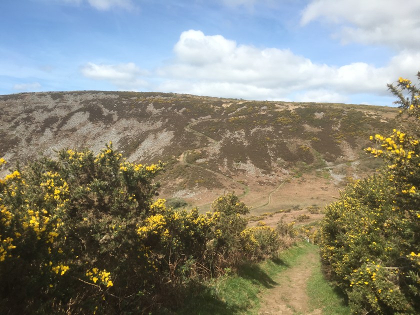
After leaving the lovely cove you are immediately faced by a steep uphill along a narrow road followed by a steep uphill up a path.

Quite quickly you reach a decent height of 300 feet or so and the views are back towards Fishguard harbour, out to sea and at the steep drop below!!

Most of the people were walking the other way, but we decided that clockwise would get the best views as we dropped down into Cwm-Yr-Eglwys  later, so we said our hellos and kept walking, it was quite a busy path.

Then after 1.2 miles we reached Dinas head and the peak of our walk at 441 feet.

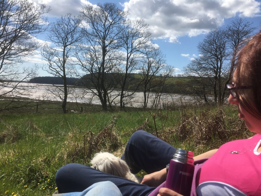
We had a sit for a few minutes while we took in the views and had a drink, then set off on the downward section, although initially every downward section was met by more upwards walking, and we past through some woodlands and alongside some cliffs with sea birds.

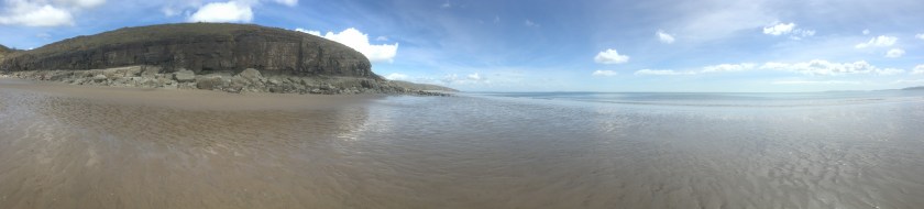
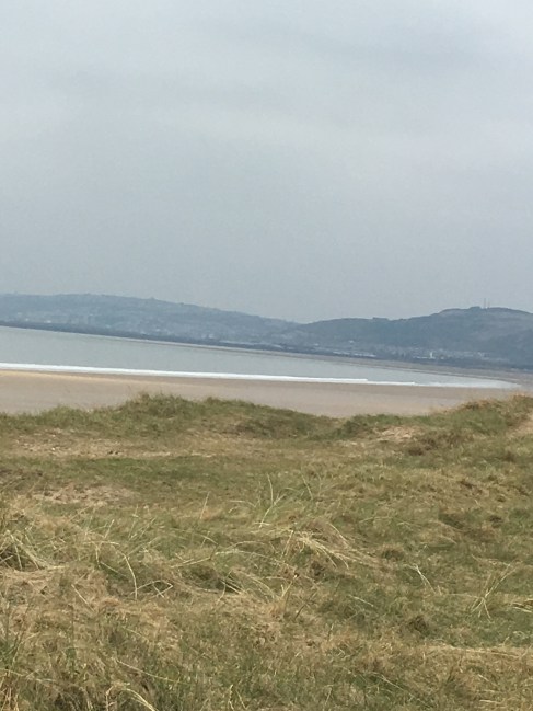
The descent then got steeper and we could see the estuary by Newport as we came down into Cwm-Yr-Eglwys.

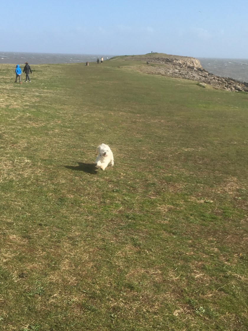
Cwm-Yr-Eglwys is a really cute small village with a tiny beach and dominated by a ruined church and graveyard.

It was at this point that Sharon realised that she no longer had Cleo’s lead, and decided that she had probably left it 1.4 miles back at the very peak of Dinas Head when we stopped for a drink. With not many shops around and the lead being rather essential we decided that we would continue with the circular loop back to the car, have a coffee and cake and then set about retrieving the lead. First we had to pass through the campsite where Sharon gave Cleo a helping hand, and then it was a straight flat 0.9 miles back to the car making 3.5 in total.

IMG_2413

I should then put all the same pictures on again as we walked 1.2 miles back to the peak, collected the lead and then walked 1.2 miles back again to the car…but the strava graphics show it best.

It is worth just mentioning our further adventure on the way back.  Sharon had heard about the Pilgrims stepping stones at Newport and although we pass through Newport on a future leg of the walk she decided we would stop in Parrog and walk a mile to the stones. As the tide was out we could then leap from one to the next right across the river….you get the picture.

So it was a short walk along the river bank to reach the bridge which had replaced the stones as the means of getting across the river. We walked over the bridge and asked some locals where the famous stepping stones were and they looked blankly at us.. and then we saw them (just!!).

IMG_2429

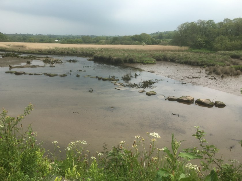
Not quite what Sharon had imaged and it turns out the ones she was picturing in her mind are actually near Brdgend!!

So in terms of the total walk today, all in it was 9.9 miles but only 2.6 miles of it was coastal path (first time around) taking us to 144 miles completes and 726 to go.

Andrew and Sharon

Barry Island Loop

2nd May 2016

After a weekend of swimming galas and Sharon working on Bank holiday Monday we decided we had to sneak a bit of coastal path walking in, no matter how short – and the Barry Island loop was just the job for late afternoon on a Bank Holiday Monday with the sun shining. But how to get the kids to walk it as well? Of course – the promise of fish and chips and the amusements!!

We parked at Barry railway station, the scene of a previous start point and got our walking boots on – and some decided on a pose.

IMG_2213
Cleo points the way

We had to head down the road and across the causeway to Barry Island, and the main car park.

At the back of the car park a short walk gets you to the coast.

IMG_2220
Coast is behind Cleo and children

Although the sun was out it was quite chilly in the breeze and by now seagulls were using the breeze to stay perfectly still in the air as we headed to Friars point.

IMG_2223
Cleo flies through the air full of energy on the way to Friars point

The walk then took us along the undercover promenade where the smell of chips was too much to resist.

IMG_2228

And along the sea front besides Whitmore Bay to the climbing wall and on round Nell’s point.

We then detoured down to walk along a small beach before walking around a few backstreets to complete the loop. Time for one last pose before we headed back to the car:

IMG_2235
The elf has too many hands

Because of the location of the car, and some extra back and forwards to the amusements we walked 6.1 miles in total but only 3.5 of it counts towards the coastal path, making our total 141.4 miles completed and 728.6 miles to go. There will be a lack of updates for a couple of weeks now while other non coastal path related activities take priority.

Andrew and Sharon

Amroth to Laugharne

24th and 25th April 2016

Sunday now on our weekend away, and the book says that we can do Amroth to Laugharne in a day – coming in at about 13 miles. That is fine – but there are no buses on a Sunday, and our caravan is halfway along the route. So for the Sunday we decide to walk from Pendine to Amroth and back else we would be stranded, and on the Monday complete the walk from Pendine to Laugharne and get a bus back. Job done – but with Sharon still having her sense of coastal rock-climbing adventures in mind and 28.9 miles already in our legs this weekend, this is not going to be easy.

Pendine to Amroth (and back)

So from the campsite we headed towards Pendine Sands and in front of us the hill showed clearly the path we would take.

As we climbed so the beach got smaller and smaller, and our breaths longer and longer…

The view from the top of the first hill (Gilman point) was magnificent

both the views out over the point, and ahead of us Morfa Bychan, a small cove of a beach. But then we saw where the path was leading us – right down to the beach and then back up the other side was another hill which looked even higher than the one we had just climbed up.

IMG_2102

I left this picture full size so that you can see the path cutting up the hillside, around 370 feet up for that peak alone. And this time you stay up high for a bit longer, with some drops but not back to sea level…

Unless of course you are Sharon. Marros beach stretched out below us, with no-one on it. We meet some walkers coming the other way and they asked if we knew a way down on to it because they reckoned that if they could get down then they could walk along the coast at low tide past Telpyn point (Left picture above) and straight into Amroth avoiding the last hill. We didn’t, but helpfully we pretended to offer up a path behind us which might go so far. In return they told us that ahead we could drop down and get on the beach and might be able to time it right to get to Amroth – just under an hour till low tide and Sharon not only wanted to walk the beach all the way to Amroth but also then stop for food and find the time to turn around and get back along the beach as well.

We went for it, and with a bit of rock climbing (but nothing like yesterday) we got around the point and onto Telpyn beach and Amroth.

IMG_2146

It must be said, Amroth is beautiful….even though the official end point of this walk (and the start of the Pembrokeshire coastal path) was right at the start of the beach, we decided to walk the length of Amroth (an extra mile or so) and it was well worth it. We could easily see the seaside house being here – definitely high on the list.

But then we had to turn around and walk back – Sharon was determined to get past the first point on the beach to avoid a hill but I wanted to note the start point of the Pembrokeshire coastal path….

Then we made it around the point before we stopped for a sandwich, and I tested Strava’s ability with a run along the beach (was looking better before we then walked right through it!!)


At this point we had a choice – someone showed us where we could get off this beach further down and back over the 2 hills to Pendine – or we could go for it and try to get round another point with the rapidly encroaching tide. Guess which Sharon chose, despite the warnings of some fishermen that it would be tricky…. so rock climbing we went again, carrying Cleo all the way, and it was a good 15 minutes of climbing..

But we made it, leaving just one hill to climb and then we were back in Pendine – today was 13.7 miles and a massive 1930 feet of ascent, despite the beach cheats!! But only 6.8 miles of coastal path. Meaning 130.7 miles completed and 739.3 miles to go.

Pendine to Laugharne

And so a leisurely morning for our last walk of the weekend, and it needed to be with blistered feet and 42.7 miles already walked this weekend.

So we set out from Pendine and the coastal path pretty much followed the road right up to Broadway.

The path then suddenly went up some steep steps and into Dylan Thomas land – starting with a sign about the famous Llareggub uprising (in case you need it explaining – read it backwards)

IMG_2173

There are benches with famous lines from his poems all the way along, and then the estuary hits you with splendid views of Laugharne castle

A few landmarks – Dylan’s original house, the shed above the boathouse where he wrote, and a pink house (nothing special about the pink house except that we saw it from a distance on Saturday and since then every time we went past a red house Sharon asked if it was the pink house, yet she missed the actual one in Laugharne, so I have to include a picture of it for her!!)

Add the end point was the bus stop where we got to on Saturday

IMG_2198

As we sat in a lovely cafe in the town centre eating a fab breakfast, and then some fab cake as well (two meals in one!!), we realised we had walked 7.2 miles today, making 49.7 for the weekend in total and all of it was coastal path, making 137.9 miles in total and only (ha ha only) 732.1 miles to go. Roll on the next weekend,

Andrew and Sharon

Llansteffan to Laugharne

23rd April 2016

It is unusual for us to walk on back to back days, but with the caravan booked for the whole weekend  we planned 4 days of walking and this is the second and by far the hardest. The book says it is 15 miles in total, and also very hilly (that will please Darren), and it is quite a trek just to start out.

To be honest – we only planned to go as far as St Clears today (about 10 miles) – hence we parked the car there in the morning (7.30!!) and got the dog friendly bus into Carmarthen, had breakfast at Wetherspoons and waited for the dog unfriendly bus (back in the rucksack again Cleo) to Llansteffan. Off at the same bus stop as yesterday but this time we went left not right and headed for the beach and the castle.

For once we were prepared and even knew that low tide was just before 2, so as we walked along the beach we could see the tide receding. The official coastal path then heads up the hill and past the castle – but Sharon has this wonderful theory that we should try to always be as close to the coast as possible, and that if the path sometimes goes in land a bit, then we should seek alternative routes.  Today was one such day. The beach was so appealing to Sharon that she decided to see if we could walk on it for as long as possible and miss a few of the hilly bits.

Our feet were sinking quite deep in the sand, at some points above the tops of the walking boots, but the sun was shining and we had the whole beach almost to ourselves.  We reached a rocky part and after climbing over a few rocks we saw a guy and his dog sitting on the rock waiting for the sea to retreat far enough for him to get the fish out of his net.

We asked him if we could carry on along the rocks and get to the next beach and a way up to the coastal path. He laughed a bit and said it would be possible in about an hour once the tide went out enough and that on the next beach there we would see a blue rope which would lead to our exit. So off we set (with his cries of “good luck” still in our ears), more mountaineering than walking and definitely slower than if we had walked up the hill, but it was fun.

At times the drops between rocks were 10 feet or more and we eased ourselves down the slippery rocks until finally we made it to another beach. We walked along looking for the blue rope but to no avail, and at one point almost got completely stuck in the sand as we sank up to our sock tops in it.

IMG_2064
A bit too sinky!!!

We passed a man farming muscles, and then continued around a corner where we could then see no way past – it was all estuary or marshland and after a bit of exploring we turned around and walked back along the beach till we found another fisherman who showed us where the blue rope was – to be fair, we had to go in through a stream and woodland before finding it and then use the rope to climb up a very steep hill.

Sharon led the way up the hill and at the top we found the coastal path and the more traditional view.

We were quite behind now so decided to stick to the coastal path for the rest of the journey, even though it had to go inland at times, and it was a mixture of lanes and fields.

We found a lovely quiet spot for lunch and a snooze in the sun.

IMG_2074
Lunch time and snooze time

At one point we went past a farm and the sign said to go through the farmer’s field, so we did and then got completely lost wandering from field to field, stepping boot deep in cow slurry this time (Andrew!!) and after an hour we gave in and went back to the farmhouse to ask for help. Turns out the route was through a field of cows (who were very interested in Cleo) and the farmer had taken down one of the signs to avoid people using it we think. We found an alternative route through a neighbouring field and continued up and over the hills.

Finally we approached St Clears – well as close as the coastal path went to St Clears by the boatyard.

The coastal path then headed off to the left to Laugharne, or the car was right to St Clears – but even that was 1.5 miles away so we decided (foolishly) that we might as well finish off to Laugharne and then get a bus back to get the car.

I was running out of phone battery life at this point and we needed to rush for the bus so pictures are limited, but it was much the same as the other side of the estuary and we spent a lot of time on or near the road. Finally we made it to the bus stop in Laugharne just in time for the last bus of the day. Laugharne itself, pretty as it looked, will have to wait until we have more time another day.

So the stats – we were supposed to do 10 miles of a 15 mile coastal path walk – but with detours ended up doing 17.4 miles of walking and all 15 miles of the section. Our total ascent was 1501 feet which was pretty impressive. That takes us to 123.9 miles of the coastal path completed, and 746.1 to go. And another walk to come tomorrow!!!

Andrew and Sharon


LLansteffan to Carmarthen

22nd April 2016

With a weekend away in a caravan in Pendine booked up we decided to tackle a few legs of the coastal path over the weekend. Friday was the only poor  weather forecast for the whole weekend but with an early enough start we might just be able to beat the rain. The only problem was that having parked in Carmarthen, the bus to get us to Llansteffan to start the walk wasn’t until 11.40 – time for Greggs!!

We were stood in the bus station with Cleo, when a woman approached us and said “they don’t let dogs on the Llansteffan bus anymore, after one did a poo”. Sharon was worried that if she did the same then all middle-aged women would be banned from the buses as well – but our problem was that we needed that bus – and we needed Cleo to be on it.  So we walked around the corner, put Cleo into the rucksack and subtly got on the bus – thinking we got away with it.

IMG_1989
Cleo poking out of the rucksack

I say “thinking we got away with it” as when we got off the bus in Llansteffan the driver said “hope the little fellow enjoys the day”, and I don’t think he was talking about Andrew!!

After a false start in the wrong direction we headed up a very long and steep hill:

And that was most of the walk really – across a few fields, along a few roads (often with the coastal path popping in and out from behind a hedge) and (according to Sharon) mainly uphill, although Strava was to disagree).

We then found ourselves in a lovely BlueBell forest, which proved a good spot for some lunch on a bridge by a stream.

Re-fueled and re-energised Sharon had a game of hide and seek while Cleo took to some showjumping.  Then we climbed some stairs and through a gate to cross the main road:

IMG_2013

Then after some more woodland and some more ups and downs we met some fellow coastal path walkers – although I suspect they are slightly more dedicated as they had been walking for a week and had got from Swansea. We shared a few tales of misadventures and then off we went to have some more!!

An arts centre proved good for a pit stop before we headed along a floodplain, passed behind the B and Q that you always see when heading to West Wales and pass some fish sculptures. The pace picked up as the rain began to fall.

The bus station was on our left but we wanted to end at the train station so that we could pick up from there another day. So we crossed on the Pont King Morgan footbridge and found the station.

IMG_2026
The finish line

So today’s walk was 11.5 miles in total in 3 hours 26,  of this 9.5 miles was of coastal path making 108.9 miles walked and 761.1 to go!!

Andrew and Sharon

Newport Wetlands to Duffryn

Today the plan was to complete part of a leg of the walk left from a previous weekend – we could not have walked any further on either our Cardiff to Newport leg, or on the 1.5 legs of Caldicot to Wetlands – so this shorter day joins up the two bits.

And what a plan we had – Leave Sharon’s car at Duffryn, Andrew then drives us both to the wetlands and parks – we walk back to Sharon’s car and then Sharon drives back to Andrew’s car – what could possibly go wrong??!! More on that later.

So at the wetlands we had to get back to the white lighthouse to resume our walk, which was 0.5 miles of walk which wasn’t on the coastal path and then off we went, following the large circluar dog walk through the wetlands.

The walk heads towards the power-station, and then ends up back through wetlands car park (2 miles done and back to the car lol), and then off across fields and through marshland.

IMG_1922
Cleo not waiting for a picture

This part of the walk felt more like a farm walk than a coastal path walk – through field after field after field, each with a bridge and double gate – which really slowed down the pace.

IMG_1928

A little past Nash Church we hit the by now typical “footpath closed” snag:

But this time we were able to climb along the outside of the bridge quite easily as there was no gap to jump across. Suddenly the coastal path joins bike route 4, and becomes much smoother for a mile.

At this point (and I don’t know why) I decided to check Sharon had her car keys ready for the end of the walk. Quite calmly Sharon said that she had left them hidden from view – in my car!! It took about 5 minutes for Sharon to convince me that she wasn’t joking and was really that “special”, but eventually I was convinced and phoned Mum’s taxis to be at the end of the route to drive us back to Wetlands.

The next part of the walk went quite industrial, walking on a narrow path on the edge of the river Usk, until you reach the Newport Transporter bridge. We decided to cross using the bridge (the roast lamb was in the oven after all!!):

IMG_1942

Then a short walk along the SDR and turn down towards Pill and the YMCA, then pass by Argos, through a tunnel and there is the car (minus keys):

IMG_1945

Luckily, next to the car was mum to drive us back to the Wetlands.

So a total of 7.2 miles walked in 2 hours and 1 minute, 6.7 miles on the coastal path, making the total 99.4 miles walked, and 770.6 miles to go. And we have now walked the entire section from Chepstow to Barry!!!

Kidwelly to Llanelli


Making the most of our caravan site location we today drove to Kidwelly and left the car at the railway station, with the plan to walk to Llanelli (13 miles according to the coastal path book) and then for Andrew to get the train back to get the car while Sharon and the kids played in the park by the discovery centre (the finishing point of the previous leg from Pen-Clawdd to Llanelli.

So here is the Kidwelly train station sign with the coastal path sign on a lamppost, and the kids and their bikes waiting for a train to pass. Cleo was ready to go, and after a short walk down a lane we got our first glimpse of the coast today.


We walked along a canal and then briefly on the main roads until we reached the wetlands, and here the winds really battered us (we had chosen to walk this way to have the wind aiding us most of the way, but here it was very much against us with 40mph gusts). Overhead there were two fighter jets having a mock battle.

Lunchbreak time and a wall sheltered us from the wind. The salt marshes here were green but it was a very low tide and when Andrew passed here much later in the day on the train the area was flooded except for the raised path.

So after marshland the coastal path then gave us forest, with a couple of miles of woodland walks. And here our book suggested we turn left and continue with 4 more miles of woodland to the Pembrey country part, but we followed the signs (maybe they are newer than the book) and went straight on until we hit the beach. Having got past the initial sand in the eyes moment we got down to the solid sand with the tide miles out.

What an amazing beach, and completely empty, we have never had a whole beach to ourselves before and we did some beach combing for shells.

The wind was at our backs now and blowing hard, with sand whistling past us, so we didn’t often look back but when we did the sky was very dark.

Trying a panoramic picture on the blog for then first time, the left being sunny, the right being rainy.

IMG_1837


The sand made some wonderful swirling shapes, the sand is flat, all the shapes are blowing sand.

Just time for Sharon and Cleo to pose before we rushed on, with the storm clouds out over the sea, although somehow the rain managed to miss us.

Then we saw a way off the beach into Pembrey country park (where the caravan was going to be before the site was flooded) and headed in land, where the coastal path went right past the dry ski slope and we stopped so that the kids could have a quick toboggan run.

And then after a climb over the toboggan hill we left the country park and headed towards Burry port on the cycle path and coastal path all in one. Looking across the estuary we could see part of where we walked on Tuesday and part of where we will go in the future.

By now the tide was coming in and the wind was making the waves quite large. Time was also ticking on and we knew there were trains at 5, 5.30, 6, 6.30 and then nothing till 8, so with a brief look at Burry port we continued the walk.

We were looking for the amazing circular shell shaped grass lands, and almost missed them till we looked behind us as we reached the barge.


Absolutely amazing, and we nearly missed it, although seeing it meant we did miss the left hand turn to go over the railway line and added an extra mile or so doubling back and up a steep bank. Then for our favourite bit of the day, we wanted a picture of us all on the grass steps, so Andrew asked a rather old passerby to take our picture. After his first attempt Andrew looked and he had turned the camera around to take a selfie, the second attempt was no better, and on the third attempt he managed to not only turn the camera round but also to take an 18 shot burst of himself…. We gave up!!! Here is his best picture.

IMG_1887


And here is the empty step which we took after he had left so as not to hurt his feelings.

IMG_1907


The pace quickened,and again we missed a poorly signposted turn which would have kept us closer to the railway track. But the bike path ran parallel and didn’t cost us much time. A little bit of history for you now and to tell you about this plague to celebrate the landing point of Amelia Earhart, the first woman to fly the Atlantic Ocean single handed in 1928.

IMG_1908


And then we suffered from a sign being turned the wrong way and ended up walking to the discovery centre along a road and not the coast, but we were not turning back now. So while the official book says the walk is 13 miles we actually walked 15.8 miles, and then Andrew had to sprint half a mile to the train station to get the train back to Kidwelly (free as no ticket collector), and back in the car to collect the family.

IMG_1912

Without doubt the longest we have walked on the coastal path in a single day (the blisters prove this), but the best day so far in terms of the magnificent scenery and the variety of the walk from marshes to forest to beach to estuary, absolutely fabulous. For the official tally… 13 miles completed on this leg (although the book might want to add a mile or two for being able to go along the beach), so that is 92.7 miles completed and 777.3 miles to go!!!!


Pen-Clawdd to Llangennith (part 1)

The full Pen-Clawdd to Llangennith walk (including optional Berges Island) is 17 miles, which is a little beyond our single day best so far. So with the caravan sited down here and the kids ready for another biking adventure we set off to nibble at this leg by walking from Pen-Clawdd to Llanrhidian, leaving a more manageable walk for another day (another of Sharon’s good ideas of course).

So we parked the car where we finished on Saturday and set off down the alley…

IMG_1749


We had another first time walkiescleo child with us today having persuaded Elise to join us (the promise of fish and chips at the end) and she chose to walk with us rather than take her bike with the other kids.

IMG_1750


No sooner had we set off though and we hit the first snag, the alleyway was flooded and impassable, although the kids on bikes rode through it ok.


This gave us an idea, and as the kids had wellies we got them to ride back, give us the bikes and we rode through while they waded back…Cleo also got a swim…You can see the remains of Andrew’s first plan, the bridge of sticks, at the bottom of the 3rd picture lol.

The walk then quickly hits the salt marshes, which are very boggy, but also very picturesque, and luckily it wasn’t high tide so it was easy to walk along.


But not always so easy to ride along….

IMG_1762


And then my favourite comment of the day from Elise. On the marshes are a lot of ponies. Cleo decided to have a poo right besides a massive pile of horse poo, So Elise calls out ‘can I have a poo bag please dad?’. My response….’Which one are you picking up first?’.

IMG_1767


Anyway, on we walked and the pace was good at just over 16 minutes per mile, although Elise was running at times to keep up. We saw another very smart house…

IMG_1770


With Cleo photobombing!! Along here were various tractors and machinery because cockles are still gathered by hand here using rakes and riddles.


The rest of this section of walk is along a narrow quiet road, alongside the salt water marshes, right up to the point where you hit the village of Llanrhidian.

In the distance you can see Berges Island, which looks well worth the extra miles on a future walk.


And here is the point at which we left the coastal path, to pick it up again another day, 3.7 miles completed.

IMG_1781


We then walked up the steep hill to the main road


And started the walk back to the car where we had left it. We had thought the road would be quicker, but actually the return journey was also 3.7 miles making 7.4 miles walked today and the total for the coastal path now at 79.7 miles completed and 790.3 miles to go.

And the reward for the kids….. some fabulous fish and chips at the fish bar we had walked past on Saturday.

IMG_1788


More walking on Wednesday so keep an eye out for another update.

Andrew, Sharon, Cleo and various children.

Pen-Clawdd to Llanelli

After walking almost 50 miles in Edinburgh last weekend (48.6 miles to be precise and not a step of it counting towards the coastal path alas), we are back on the trail this weekend, with kids in tow.

As luck would have it we have a few days on Gowerton caravan site with the van, and the coastal path runs right by the front door…. how convenient, and our first walk on the Carmarthenshire and the Gower section of the coastal path.

We are sited about a third of the way along the Pen-Clawdd to Llanelli leg of the path so for Saturday we decided to turn left and pick up the first third. That bit was sensible, however, letting the kids take bikes on a non-bike path section was slightly less sensible.

So we turned left out of the campsite and walked to the main road, where across the other side of the road the coastal path ran down an alleyway and into a muddy wood.


There were a few stiles and gates to navigate with the kids bikes, as well as 4 inch deep mud in places, and a few bemused looking sheep, not used to seeing people on bikes. After briefly touching the road at one point, the coastal path then joined the road for the rest of the journey into Pen-Clawdd.


The rest of the way followed either the bike path or pavements and ran along beside the Burry estuary.

Continue reading “Pen-Clawdd to Llanelli”

Margam to Aberavon Sands

Well it is the first day of Spring and we have decided to increase the pace and start walking some weekends with the kids as well (well some of them at least) – might be harder to convince the big ones!!

The compromise on this route was that because most of the walk coincides with national cycle path 4, the kids were allowed to use bikes (plus with them riding ahead then coming back they did even more miles) and it allowed Cleo to get a ride part of the way.

So we parked up at junction 38 of the M4 by Margam Crematorium and walked towards Aberavon Sands – this isn’t a single leg in the book we are following – but the end of the Porthcawl to Port Talbot route, and the start of the Port Talbot to Swansea route, so it will make both of those legs a bit more manageable in future weeks.

IMG_1407
Cleo getting ready in her basket

We soon found the coastal path sign (along with the alternative red route which goes through Margam park) – do we have to walk that as well in the future to say we have done it all lol?

The first couple of miles really are not anything to write a blog about – So Cleo stayed tucked up in the basket with Rhiannon navigating.  Here is a selection of what we saw!!

Then you end up on the main road to Aberavon and past a new blue cycle bridge, and along an estuary which is when it starts getting more picturesque and Cleo got to stretch her legs and walk for a few miles.

You head up a slight hill, and suddenly notice sand on the path and as you walk around a corner – bang – the most amazing views:

The walk along the sea front is beautiful (as long as you don’t look behind you towards the industrial area) and we stopped for hot chocolate and cookies on, of all things, a whale!!

IMG_1435
I’m queen of the whale
IMG_1436
Sharon chilling with the penguins

We decided to walk a bit further, so that when we resume this walk another day we can cut down from Baglan station, so it meant walking as far as the kids could cycle before the path diverted in land.

IMG_1437
Taking in some art (or trying to scale it)
IMG_1440
What a view!!

And that ends the coastal path element for today 6.5 miles done, making 63.5 miles completed and 806.5 to go.

But we had to get back to the car – so in a first for us, we had to then walk back again!! After a stop to play on the beach of course:

Nothing much to say about the return journey, pretty much the same as the way there and thankfully the kids rode a bit slower (until they got a couple of mini magnums inside them!!).

But it was good for us to have pace setters to keep us moving – according to Strava the total was 22.1 km (which is 13.7 miles in total today), and we managed it in just over 3 and 3/4 hours. Definitely getting fitter which is a good thing with all the walks we have got planned in the coming weeks, sometimes back to back as well – might have to take the kids again.

Andrew and Sharon